|
|
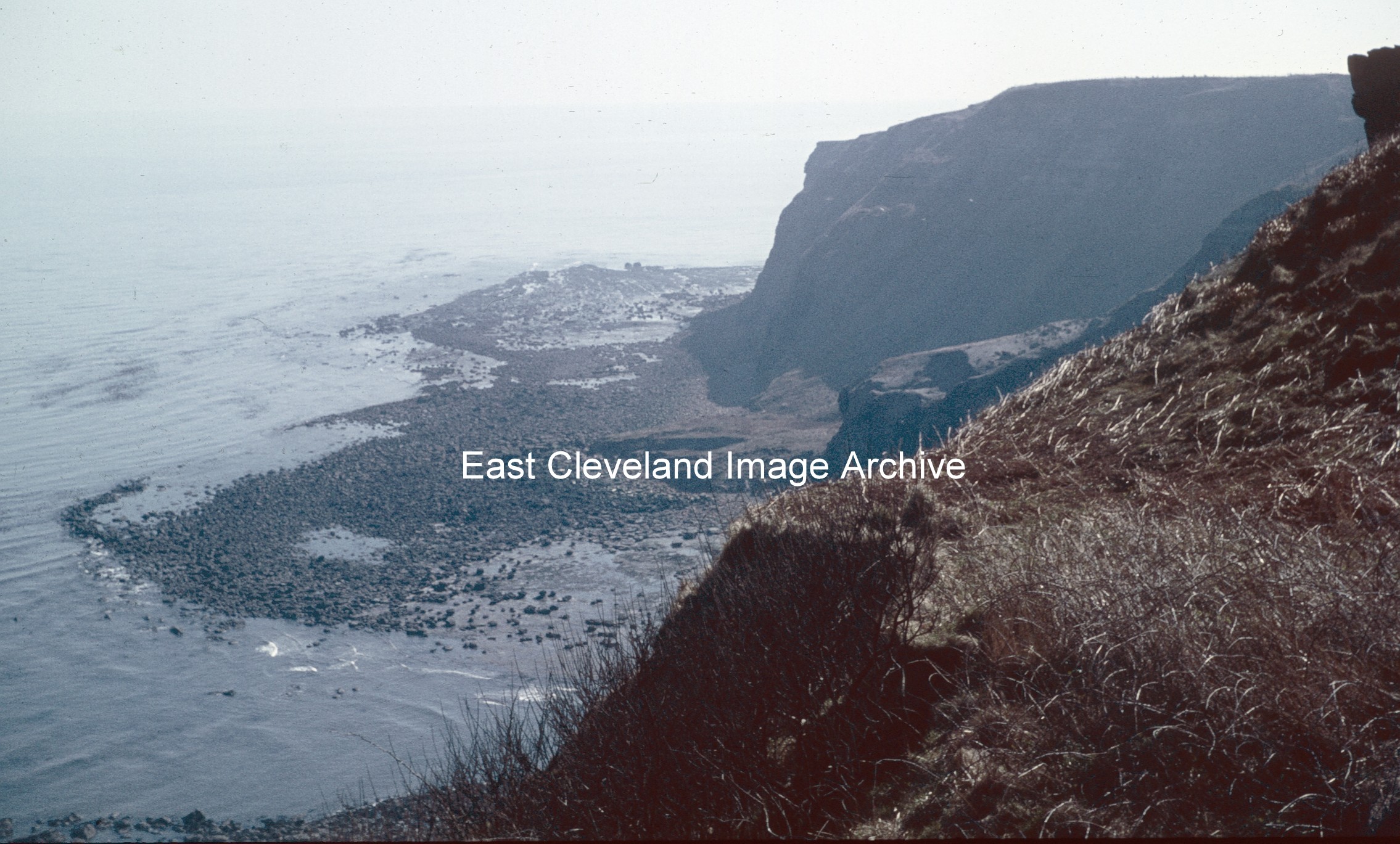
Now known to be Keldhowe Point and not Kettleness Point; as David Richardson advised: “It was taken on Ovalgate Cliffs and is looking east across Loop Wyke towards Tellgreen Hill and Keldhowe Point.” Peter Appleton commented: “This is an interesting view. Note the enormous debris field of boulders behind the words “East Cleveland”. These boulders are the legacy of the massive landslide of 17th December 1829 which destroyed the village of Kettleness and the alum works. Mercifully, it took the form of a “rotational slump” and nobody was killed or seriously injured. By mid-summer 1831, the alum works had been rebuilt at a higher level in the quarries and production had been resumed. The works would continue in operation until 1871, being one of the last two north-east Yorkshire works to close.”
Image courtesy of Robert Goundry; thanks to David Richardson and Peter Appleton for the updates.
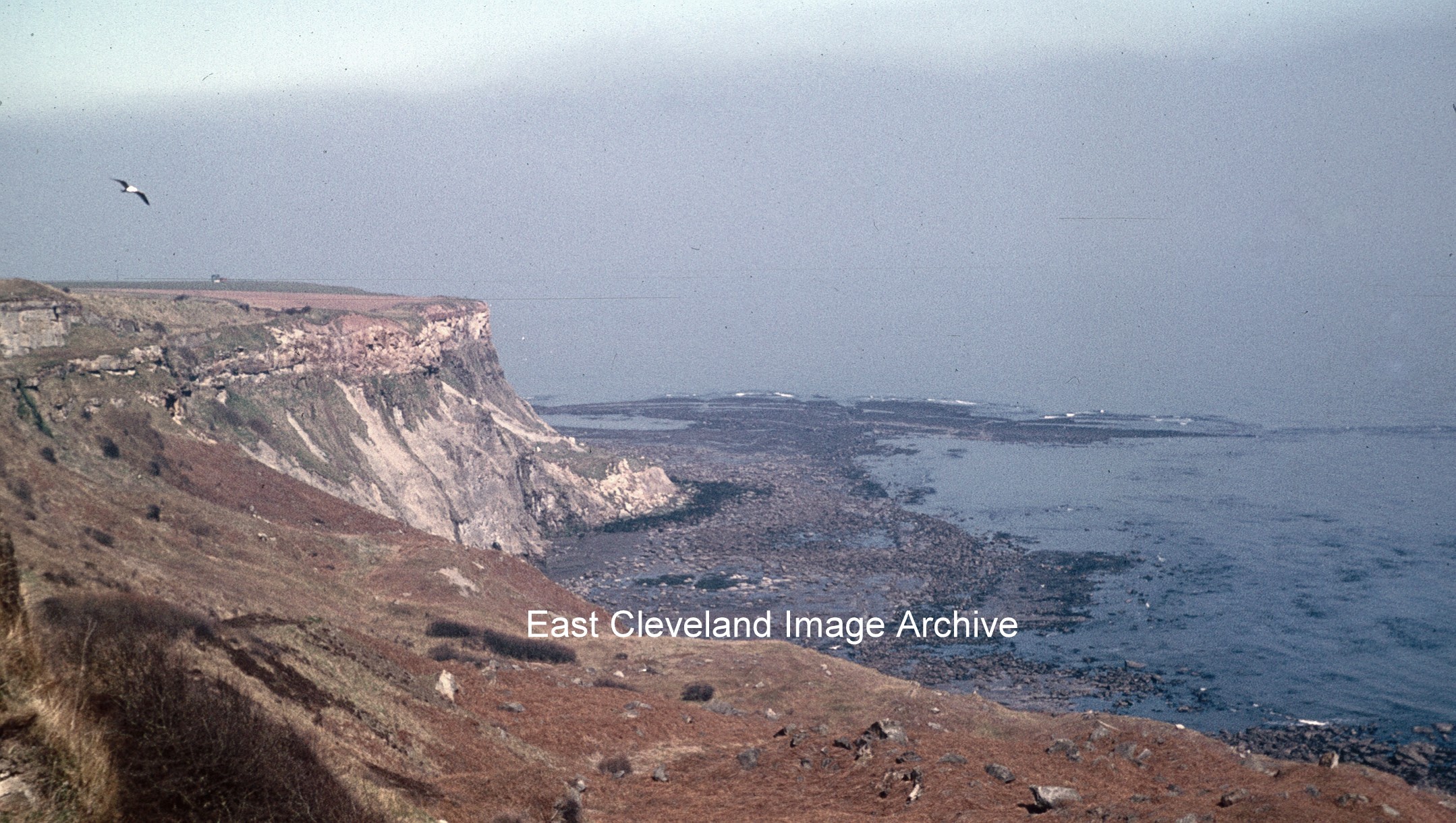
A view of ‘Lucky Dog’ point taken from the cliffs above Holmes Grove, in the 1960s. Kettleness Point is a little further along the coast.
Image courtesy of Robert Goundry, thanks to David Richardson for the update.
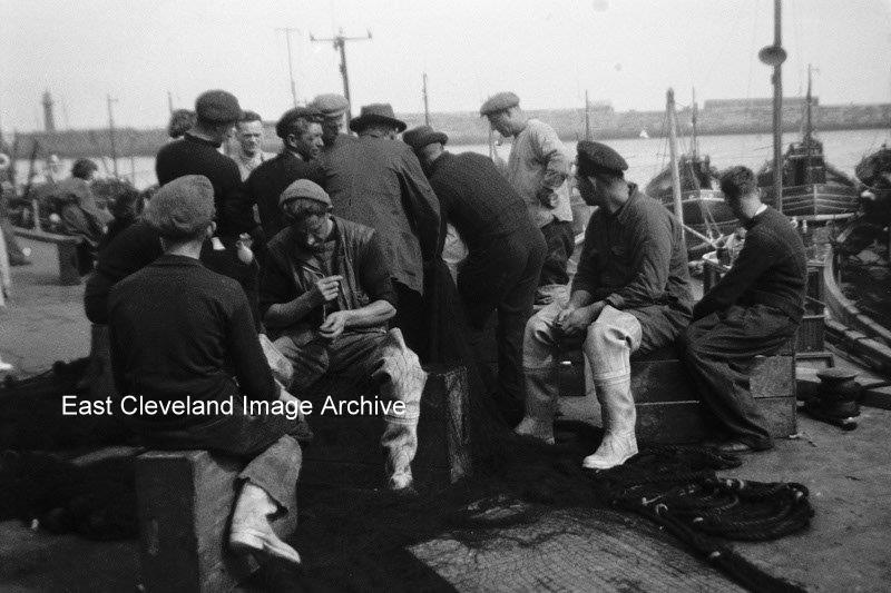
Taken in the 1950’s on a Kodak Brownie box camera this image of the fishermen on the quayside at Whitby brings back memories of a time past which many will remember. Taken by and sent to the Archive by Brian Hudson; he was born in East Cleveland and now resident in Australia. He has lived all over the world, living in Liverpool and Middlesbrough many of his Cleveland images are housed in Teesside Archives collection.
Image and notation courtesy of Dr. Brian Hudson (Queensland University of Technology).
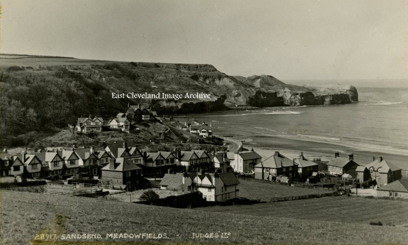
Meadowfields is actually part of East Row, being that part of Sandsend first encountered as the approach is made from Whitby; it is the houses leading off at a right angle from the road. It is only after crossing over East Row beck that Sandsend is properly entered; the view from a Judges postcard is minus the East Row viaduct which was demolished in 1960, following closure of the line in 1958.
Image courtesy of Iris Place.
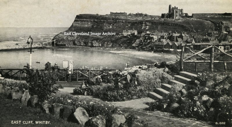
This Valentine’s postcard view taken from above Kyber Pass (just beside the whale bone arch looks towards Whitby Abbey and the east cliff. Dating from the 1950s, the flower beds and hand rails are much changed today.
Image courtesy of Iris Place.
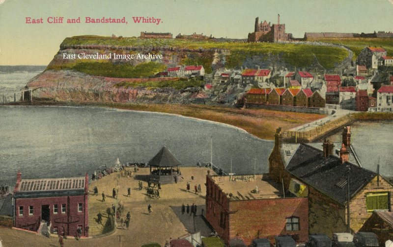
An un-mailed postcard is from the early 1900s, hand tinted it presents a colourful view of Whitby Abbey and Tate Sands.
Image courtesy of Iris Place.
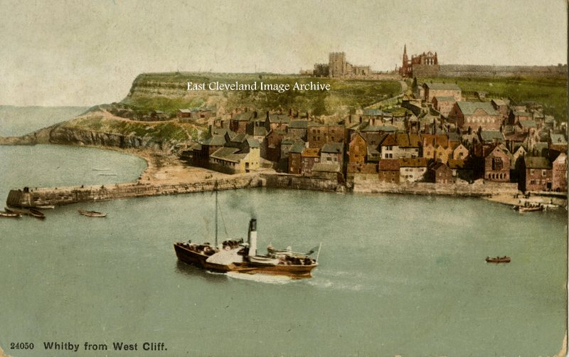
This Photocrom postcard dates from 1909 and is delicately hand tinted. Even in those days the senders were enduring ‘wretched weather’, some things never change.
Image courtesy of Iris Place.
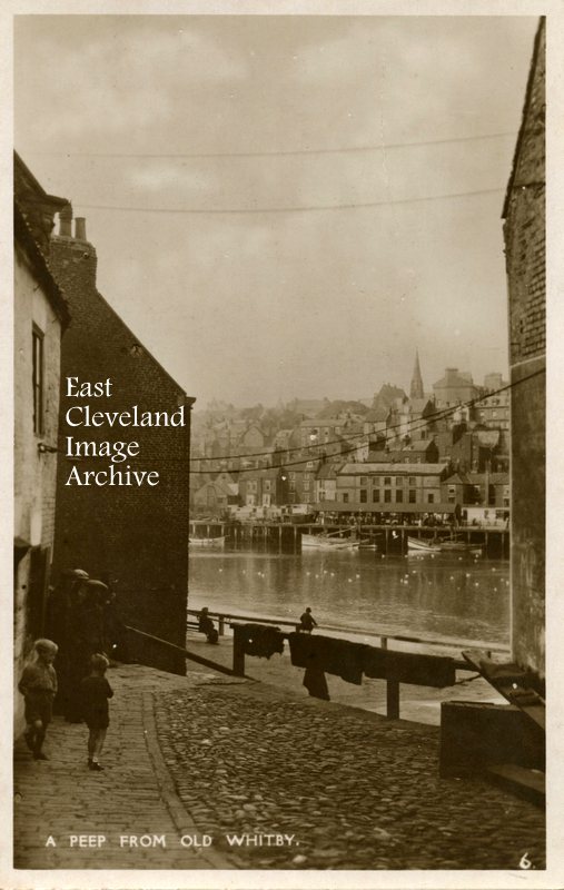
This enchanting postcard view is very aptly entitled, dating from the 1950s; similar views can still be gained and this despite the thronged main and side streets on both sides of the river. Although the younger people are differently dressed today, the older fishermen still bear an uncanny resemblance to those in this view.
Image courtesy of Iris Place.
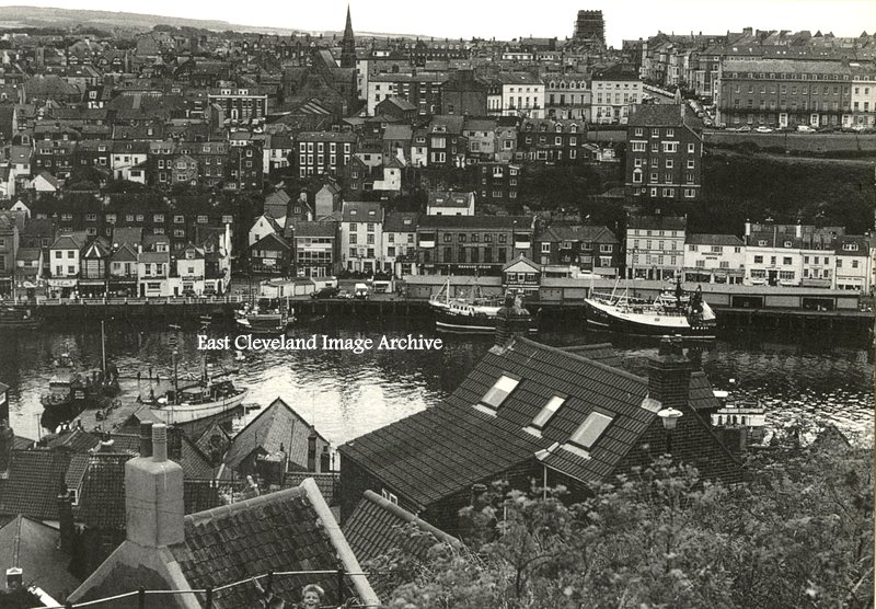
Viewed from the famous 199 steps, this 1960s view of the fish quay and market is still unchanged today, although the numbers of boats regularly using the quay and market is now much reduced. Also the long familiar ice making equip ment is now gone. But the hopeful younger fishermen still throng the harbour sides fishing for crabs and fish.
Image courtesy of Irish Place.
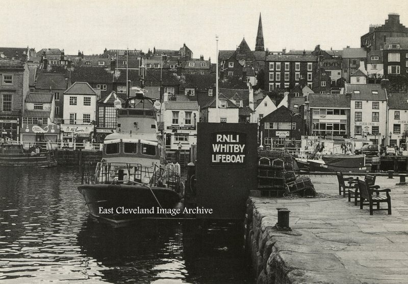
Whitby’s Trent Class All-Weather Life Boat ‘George and Mary Webb’ on station at Whitby; the boat arrived in 1994; it has a range of 250 nautical miles and can reach speeds of 25 knots. The boat is designed to lie afloat (it does not have to be launched) as it is ready to go at any time; a useful attribute when considering the history of earlier lifeboats at Whitby and difficult launches.
Image courtesy of Iris Place.
Page 1 of 3412345...102030...»Last »
|
|


Recent Comments