|
|
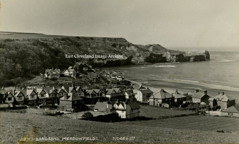
Meadowfields is actually part of East Row, being that part of Sandsend first encountered as the approach is made from Whitby; it is the houses leading off at a right angle from the road. It is only after crossing over East Row beck that Sandsend is properly entered; the view from a Judges postcard is minus the East Row viaduct which was demolished in 1960, following closure of the line in 1958.
Image courtesy of Iris Place.
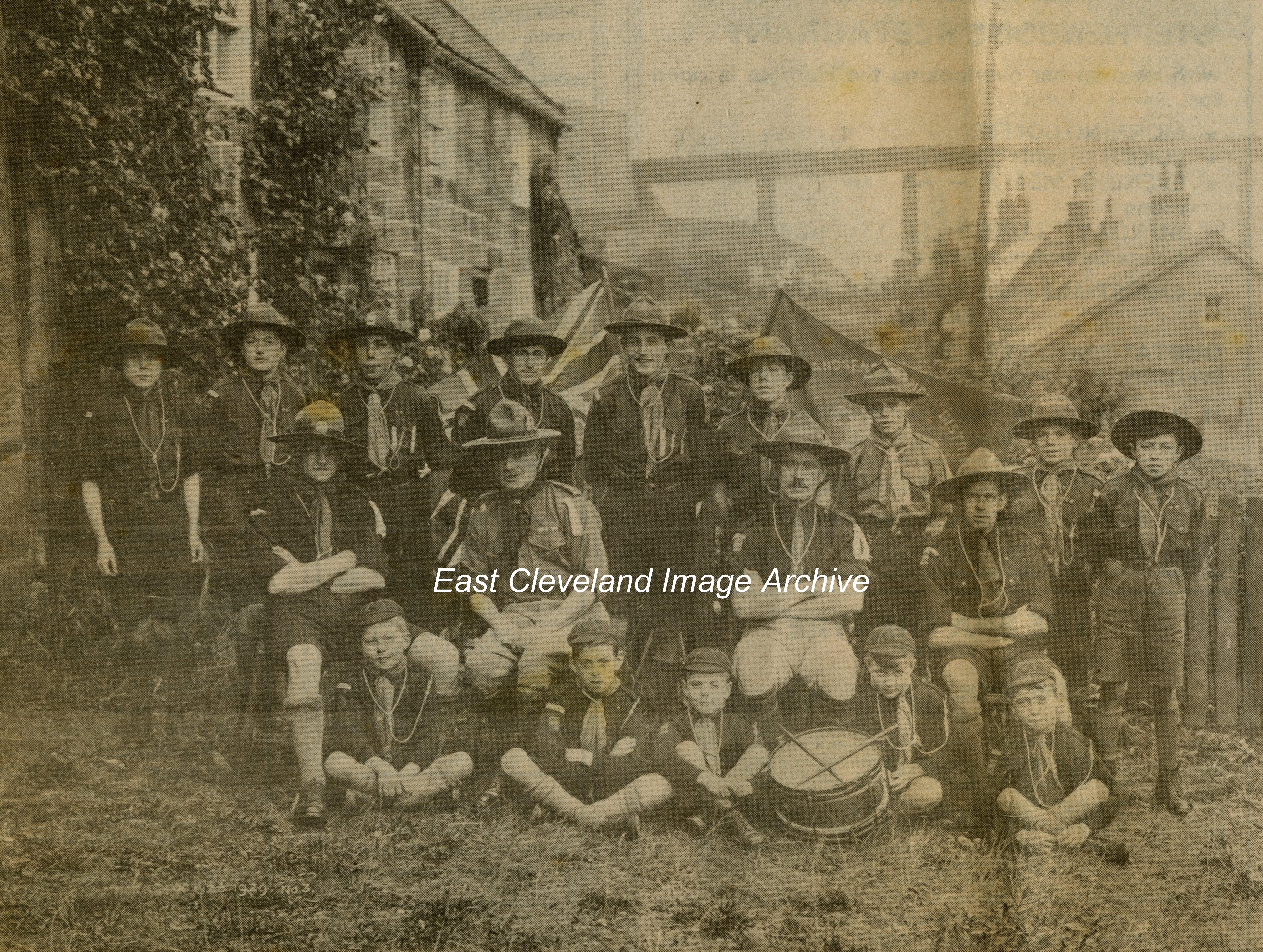
Pictured at Sandsend with the railway viaduct in the background; the Cubs and Scouts of Sandsend had assembled.
Back row (left to right): D. MacLean, R. Sleightholme, John Young, G. Crosby, H. Crosby, H. Foster, W. Mead, T. Waller, W. Stamp, C. Thomas.
Middle row: J. Robson (Cub Master), Dr. Tinley (District Commissioner), T. Walker (Scout Master), W. Braithwaite (Assistant Scout Master).
Front row: F. Stonehouse, S. Sparks, B. Waller, T. Pybus, Reg. Carass .
Image courtesy of John G Hannah (originally from Whitby Gazette “Down Memory Lane” 1980).
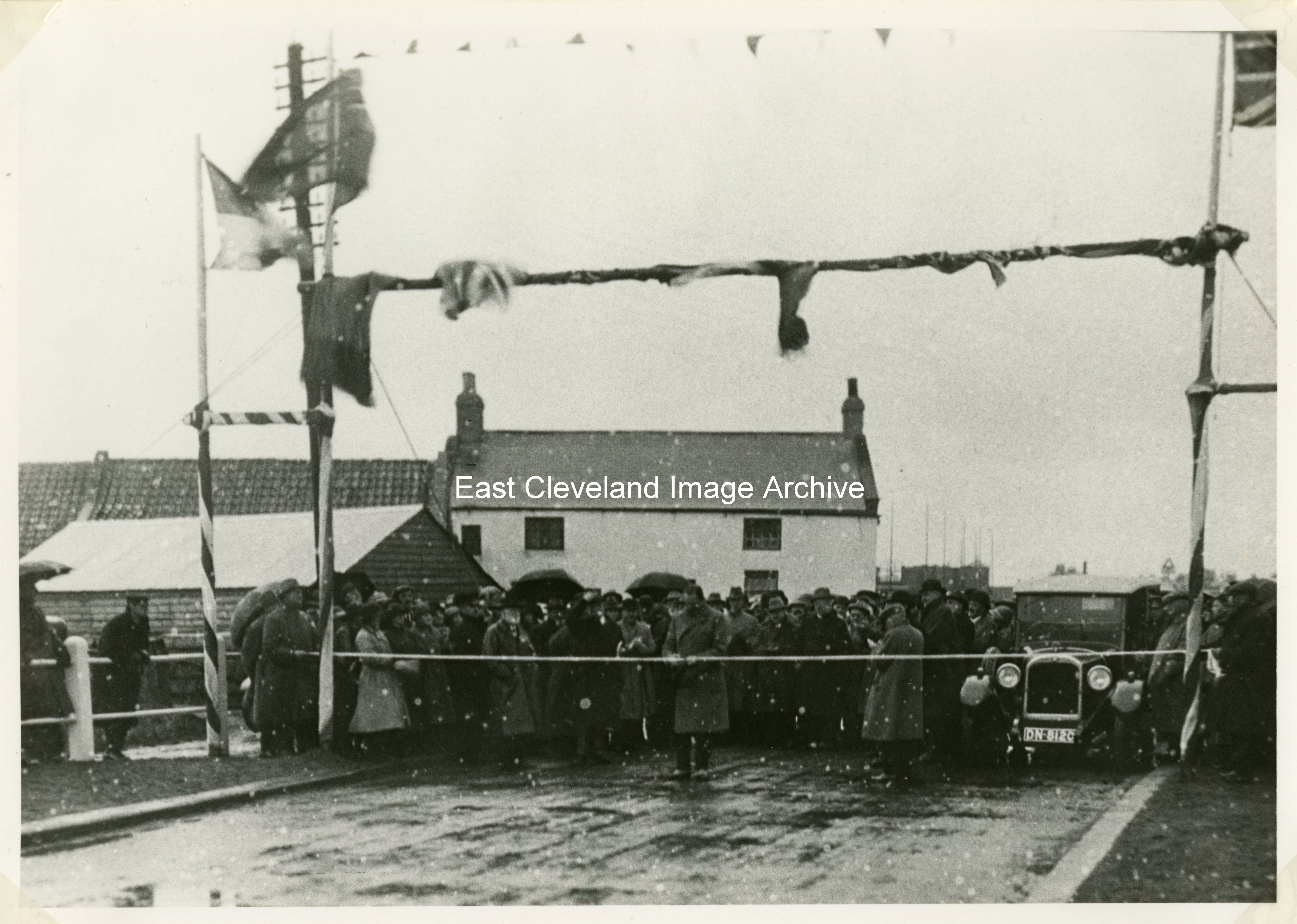
The official opening of the Whitby to Sandsend road on 7th November 1925, this image is from an original taken by Tom Watson of Lythe. He had been commissioned to record the week by week progress of this activity.
Image courtesy of the Pem Holliday Collection.
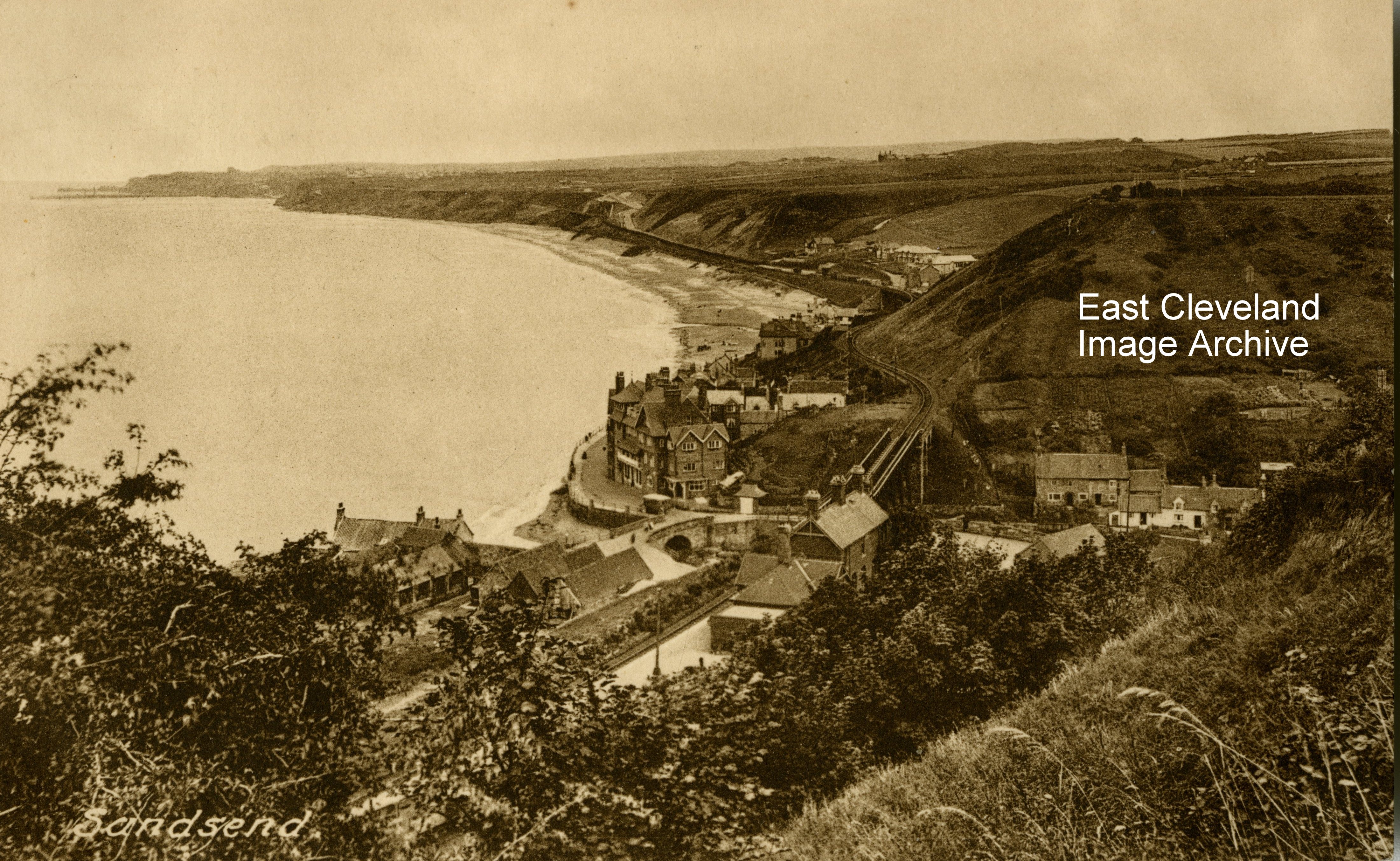
This Frith’s postcard view of Sandsend, promoting Wilcock’s Stores Ltd, Sandsend; gives an excellent view of the Sandsend viaduct as it crosses the valley towards the station, as well as a view of the Alum House area at the bottom of the notorious Lythe bank.
Image courtesy of John G. Hannah.
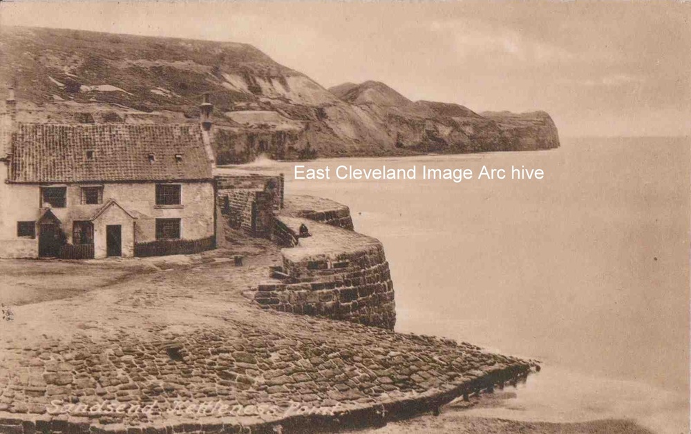
The title on the card is actually incorrect! Maps of the area define this headland as Sandsend Ness. Kettleness is actually some two mile further up the coast and not visible from Sandsend. It is still an excellent postcard view of the original Alum House which is now the area of the car park at the bottom of Lythe bank. The postcard, produced by Friths is postmarked from 1932.
Image courtesy of John G. Hannah.
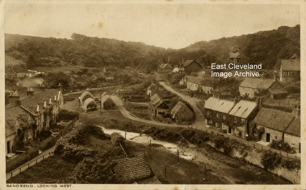
This Tom Watson postcard dating from 1927, the sender tells of travelling round the moors and was considering a cycle ride from Sandsend to Goathland, an energetic sort! Unfortunately as Peter Appleton points out; the card’s title is incorrect. this view is more south westerly than west.
Image courtesy of John G. Hannah, thanks to Peter Appleton for the update.
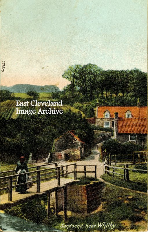
This postcard view of the footbridge in Sandsend, which can still be viewed today – although slightly improved – dates from c. 1900. Perhaps the lady is returning with her laundry from the washing line?
Image courtesy of Olive Bennett.
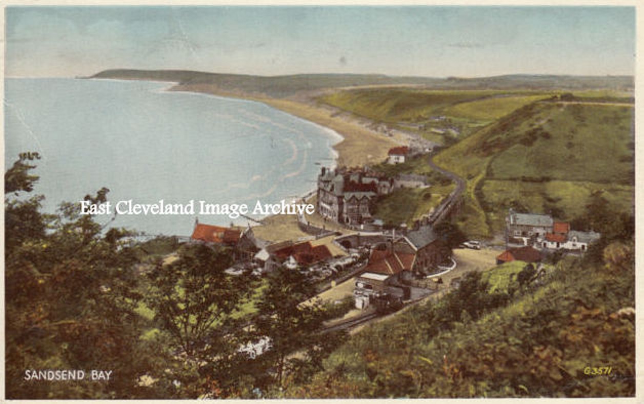
A hand tinted postcard view of Sandsend and the bay towards Whitby. The view has been taken from above the railway station and includes an excellent view of the original Alum House and it’s attendant buildings.
Image courtesy of a supporter of the Archive.
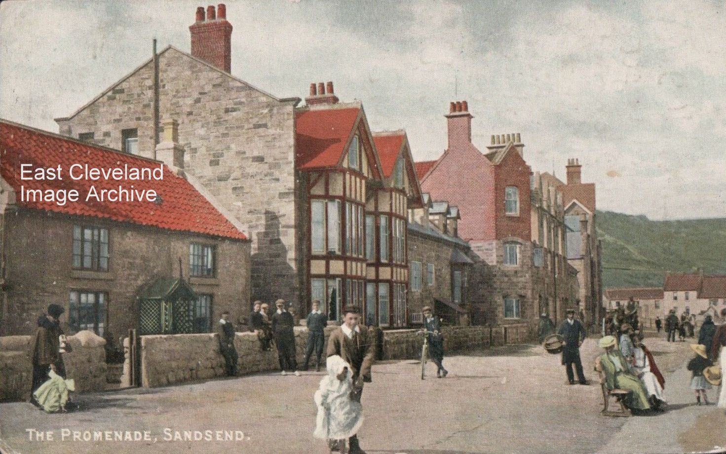
This delightful scene is taken from a local postcard producer – H. Sayer, Post Office, Runswick – perhaps he was in competition with Tom Watson of Lythe? Titled ‘The Promenade, Sandsend’ is quite a bit of artistic licence; considering it is the road along the front. Today it is often ‘bathed’ from the sea on high tides; but more limiting is the traffic, either parked on the left hand side or the rapidly moving traffic.
Image courtesy of Joan Jemson.
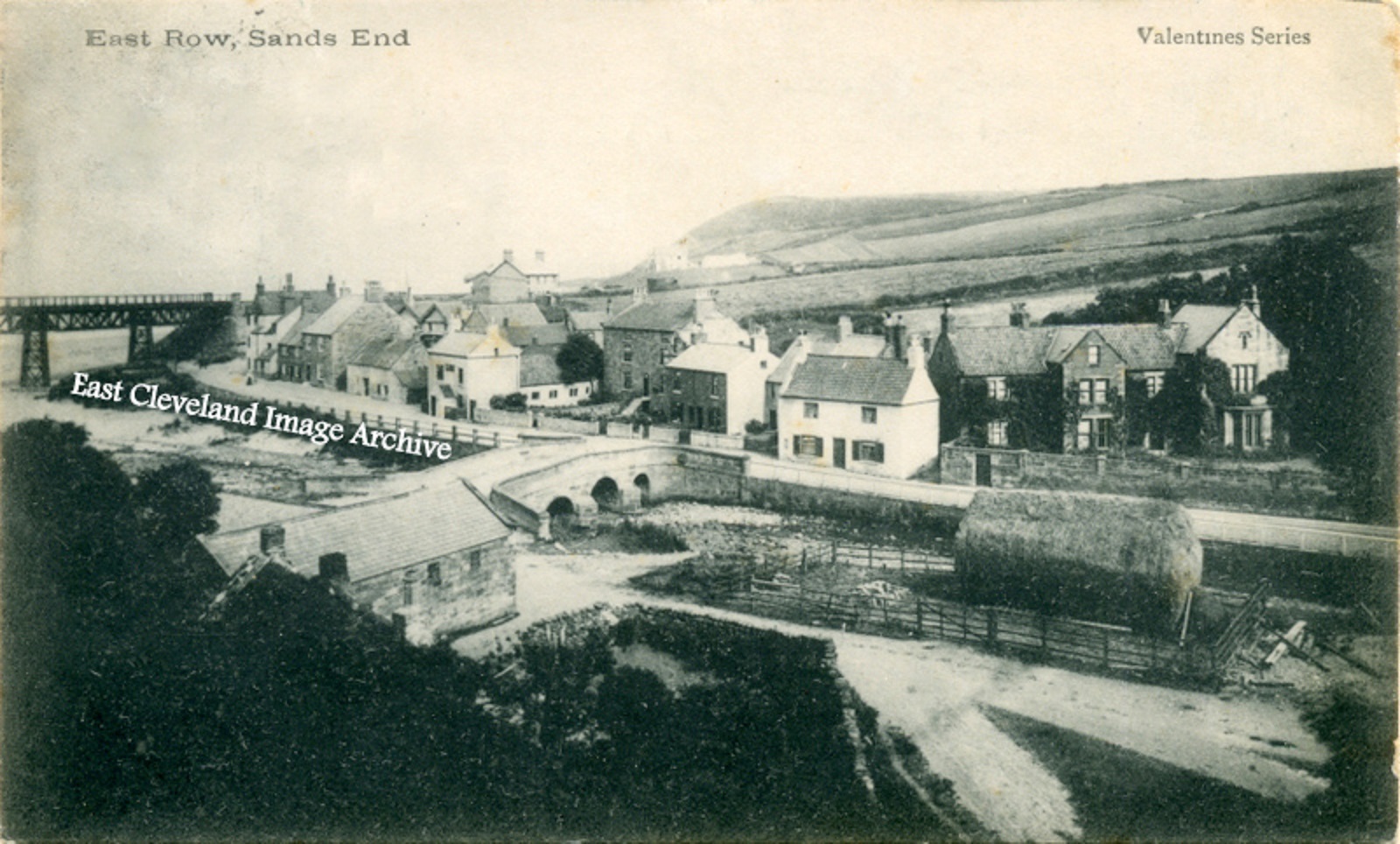
A Valentine’s series postcard post marked 1904, showing a quiet village undisturbed by motor traffic. How different today?
Image courtesy of Ann Wedgewood and Keith Bowers.
|
|


Recent Comments