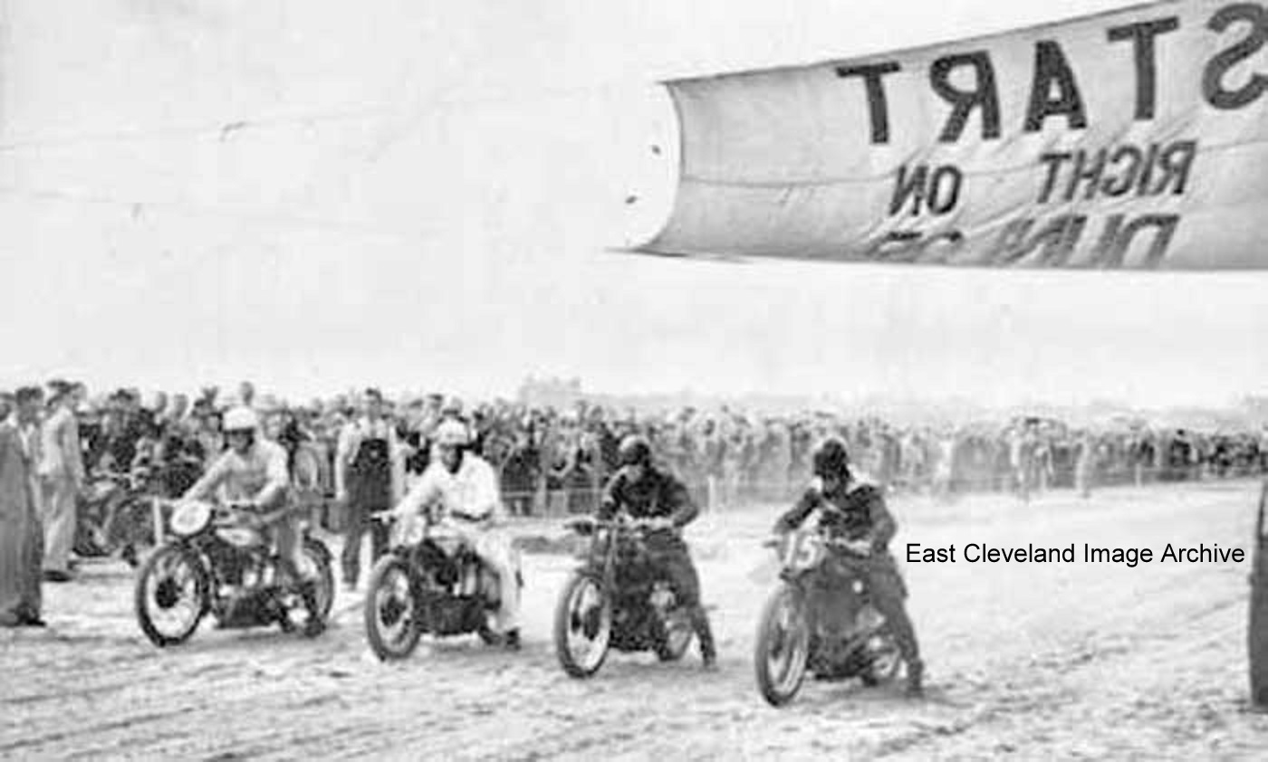
Yes here we are again racing on the sands at Redcar and this time it’s motor bikes.
Image courtesy of Mike Holliday.
|
|
||
 Yes here we are again racing on the sands at Redcar and this time it’s motor bikes. Image courtesy of Mike Holliday. 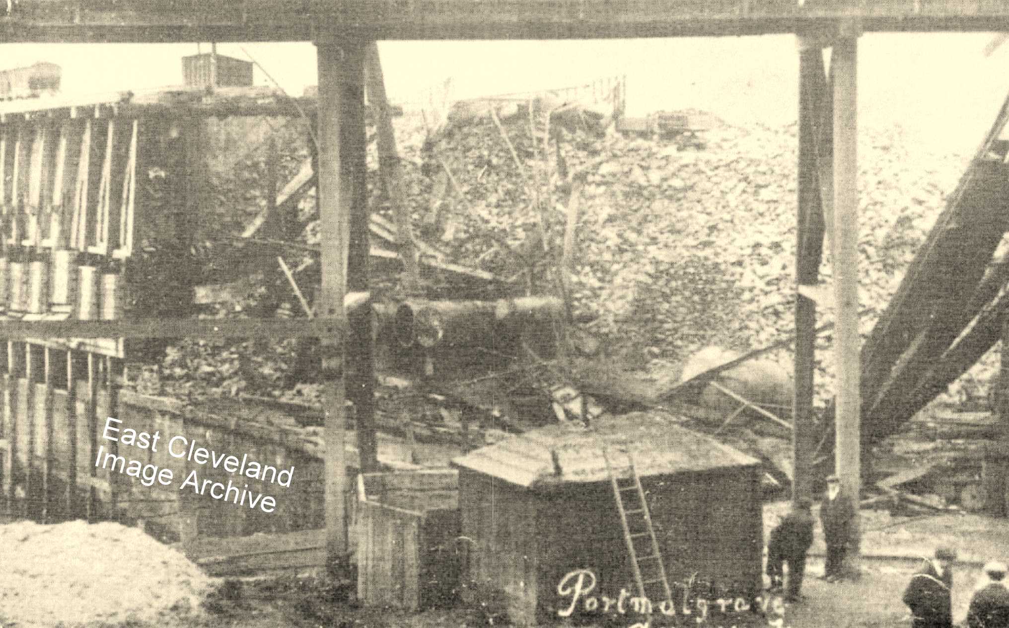 When this photograph arrived to the Archive it was believed to be of the ironstone bunkers at Port Mulgrave. This was confirmed by Simon Chapman who explained: ”This was a fire at Port Mulgrave about 1911. You can see it has burnt out the engine room and boilers for the rope haulage system through the tunnel to Dalehouse, exposing a section through one of the bunkers for loading ironstone into ships in the harbour. The big mound of ironstone to the right was usually built up when sea conditions prevented ships docking and taking normal shipments away. The damage was later repaired and the harbour got back to normal operations.” Image courtesy of Cleveland Ironstone Mining Museum and Maurice Grayson; also many thanks to Simon Chapman for the supporting information. 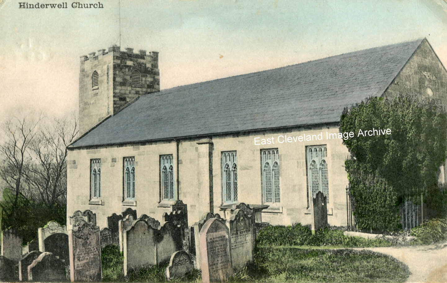 This view of St. Hilda’s Church, Hinderwell is from a card was posted in Whitby on 14th March, 1905 and is believed to have been produced by Tom Watson of Lythe. Image courtesy of Beryl Morris. 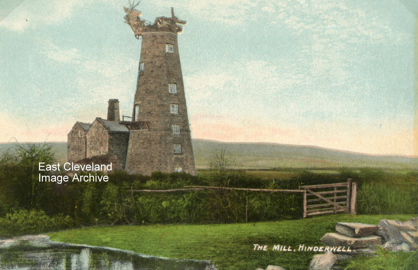 This image Hinderwell wind mill is from a Tom Watson of Lythe post card, un-post marked we are unsure of the precise date. The mill was built in 1820 by Isaac Moon who was also miller at the Dalehouse water mill, it stood seven storeys high and powered by four sails. In 1870 a steam engine was installed to help power the mill. Villagers used to hold dances on the mill floor and it was dismantled in 1915. The mill is marked on old maps and was behind the High Street, to the south west, between the road and the railway. It would have been close to where the Serenity Camp Site is now. Image courtesy of Beryl Morris, Maurice Grayson and Olive Bennett. 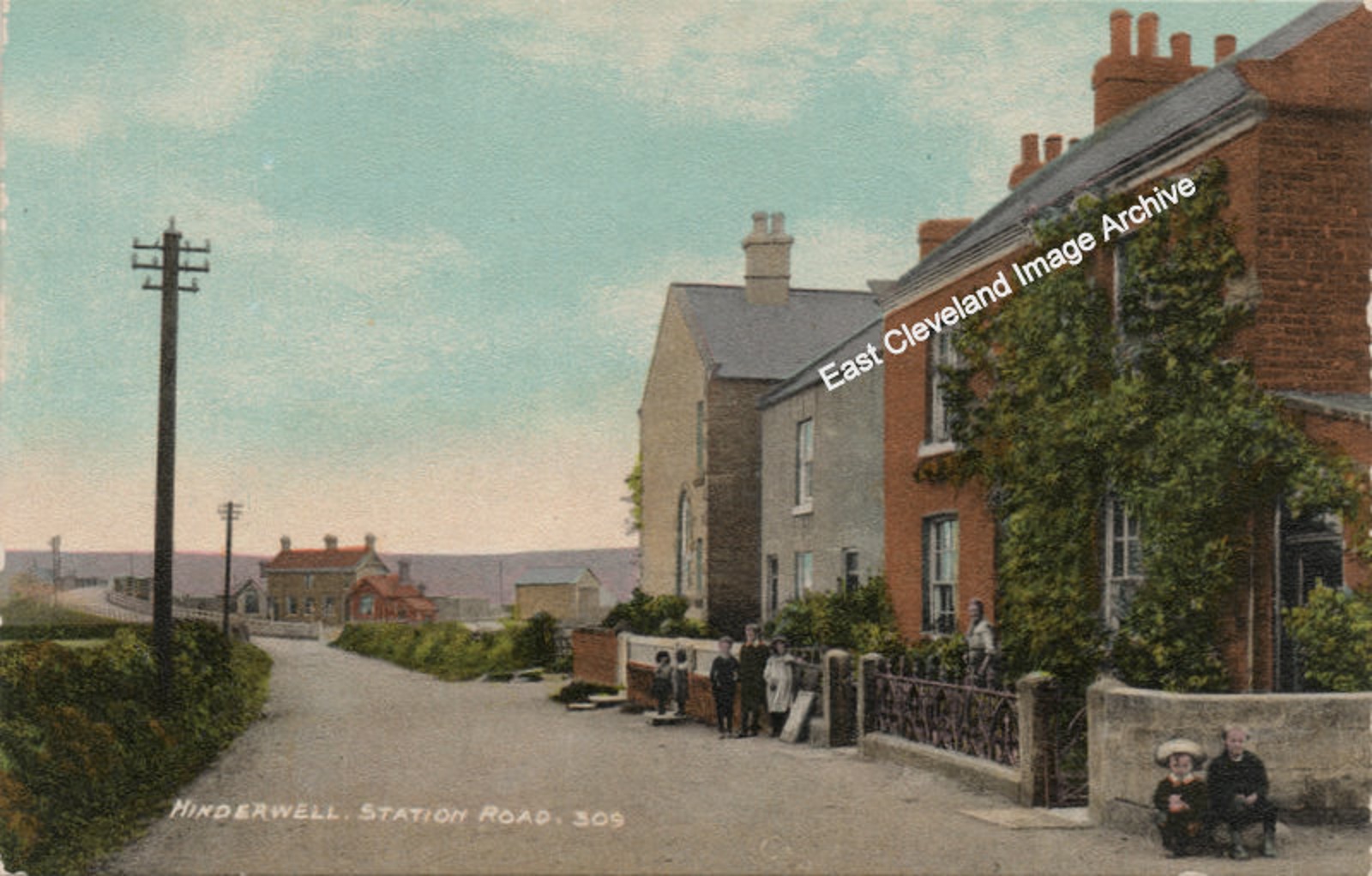 A very different view of the road everybody assumes is Station Road (it originally lead to Hinderwell Station – now sadly gone) but in reality is Brown’s Terrace. The corner visible to the right of this view adjoins the A174 as you drive through Hinderwell towards Whitby, just beyond the war memorial and Runswick Lane. The station site is now small industrial units. Sheila Roots advises: ”The little boy in the sailor suit is my father – William Harrison who lived at 4 Brown’s Terrace. I think the other boy is called Jack and they are sitting at the top of the lane leading to Brown’s Terrace. My brother and I used to stand on the bridge and watch the trains go underneath.” Image courtesy of Beryl Morris (from a postcard published by Tom Watson, Lythe), thanks to Sheila Roots for the update. 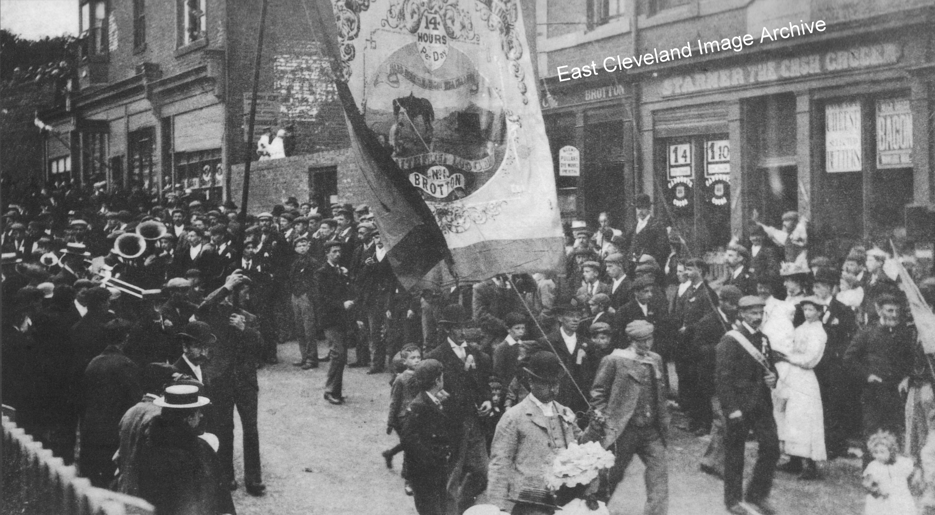 This photograph of a parade with the North Yorkshire and Cleveland Miners’ Union banner down Brotton High Street in 1908, shows the No.1 Faithful Lodge (Brotton). The original image came to the Archive in 2010, however the Archive is indebted to Chris Twigg for the provision of a much improved image. It is interesting to note that the building which presently houses the Fine Food Outlet, Handy Pearson Property Services and R. A. Howard & Sons is incomplete; otherwise the High Street buildings remain very similar to this day. Image and information courtesy of Mrs. L. Johnson and Chris Twigg. 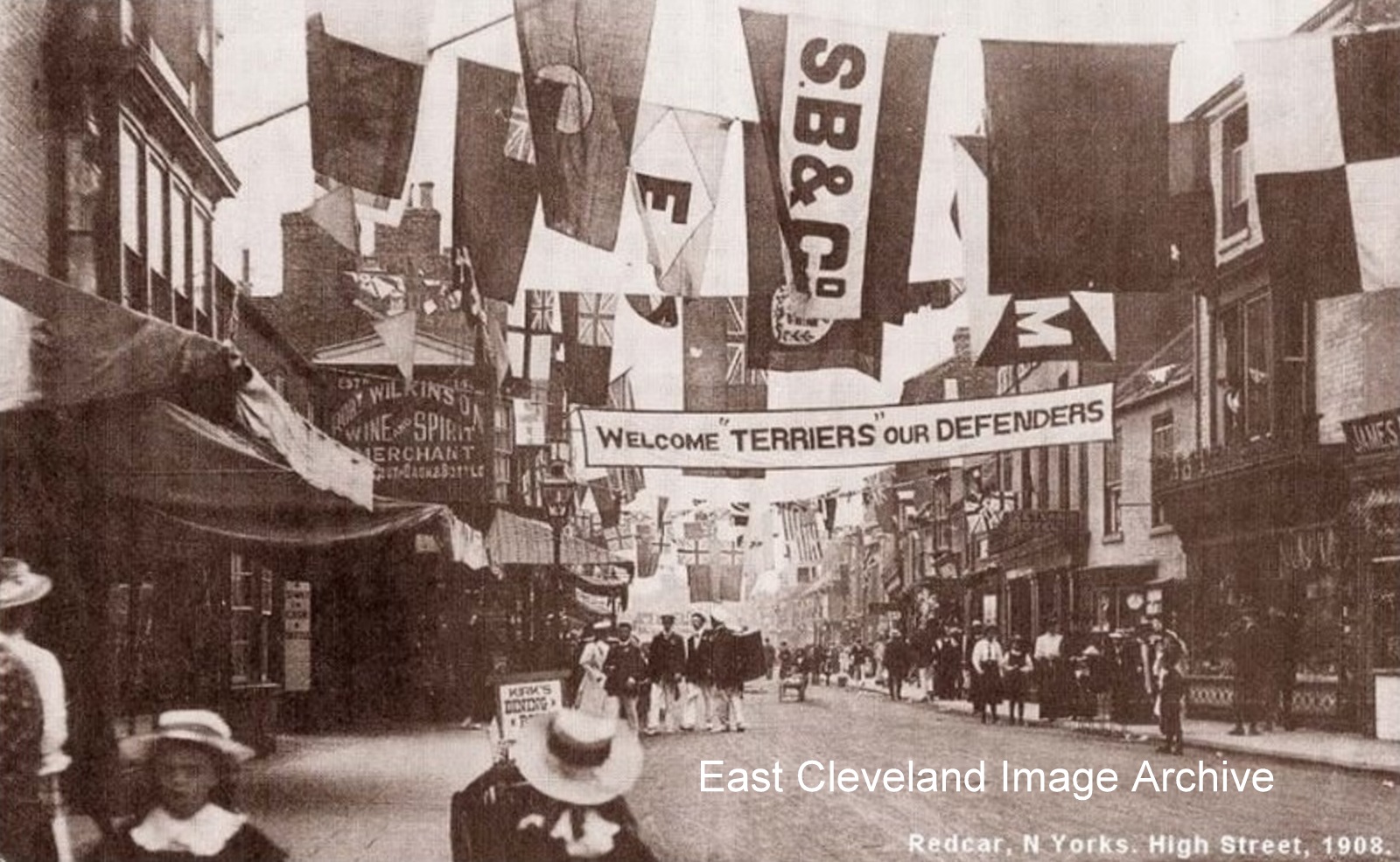 Redcar High Street in 1908; the old Red Lion hotel would be somewhere on the left of this image. Bill Danby advised: ”The Annual Camps of the Territorial Forces were held all over the country and Redcar was a regular venue for the camps along with other usually seaside places. The hard training camps were seen as a holiday by lads who spent the rest of the year down pits and in factories. The local 4th Yorkshire Battalion, Territorial Force were else where in this year but did have their camp at Redcar in 1913. Image and information courtesy of Bill Danby. 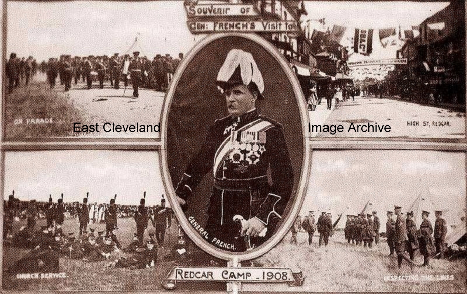 A further postcard on the occasion of General French’s visit to the Annual Camp of the Territorial Force at Redcar in 1908. General French was in command of the British Army at the start of the First World War until May 1915. Image and information courtesy of Bill Danby. 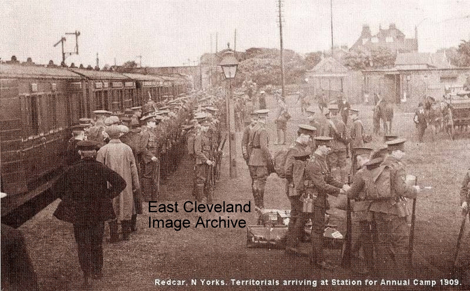 1909 when once again the Territorial Soldiers arrive at Redcar station for the annual camp. This area of Redcar Station now being car parks; the bridge carrying Locke Road visible in the background. Image and information courtesy of Bill Danby. 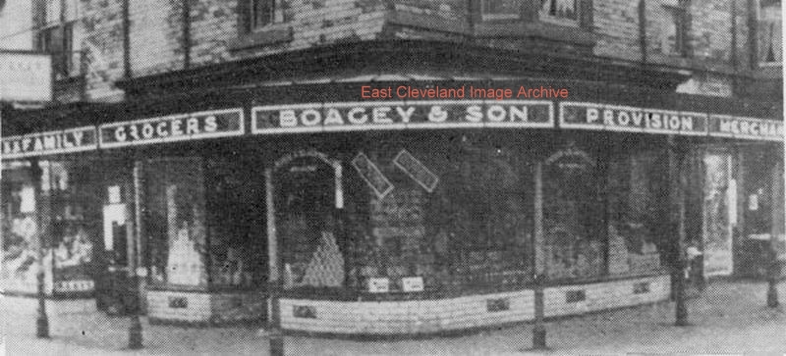 This view of Boagey’s shop in Redcar is much changed from the present day situation on the corner of Millbank Terrace in Redcar, at the junction with Station Road and Coatham Road. The shop front has changed and is now Marco’s 2 takeaway, but the ironwork has not been lost and is now stored at Kirkleatham Museum. Owen Rooks advised: “This is definitely Redcar; the Evening Gazette ”Remember When” of July 2010, where ’Then and Now’ photographs included this end of Station Road.” Image courtesy of Mike Holliday, thanks to Fred Brunskill, Mark T. and Owen Rooks for the updates. |
||
Recent Comments