|
|
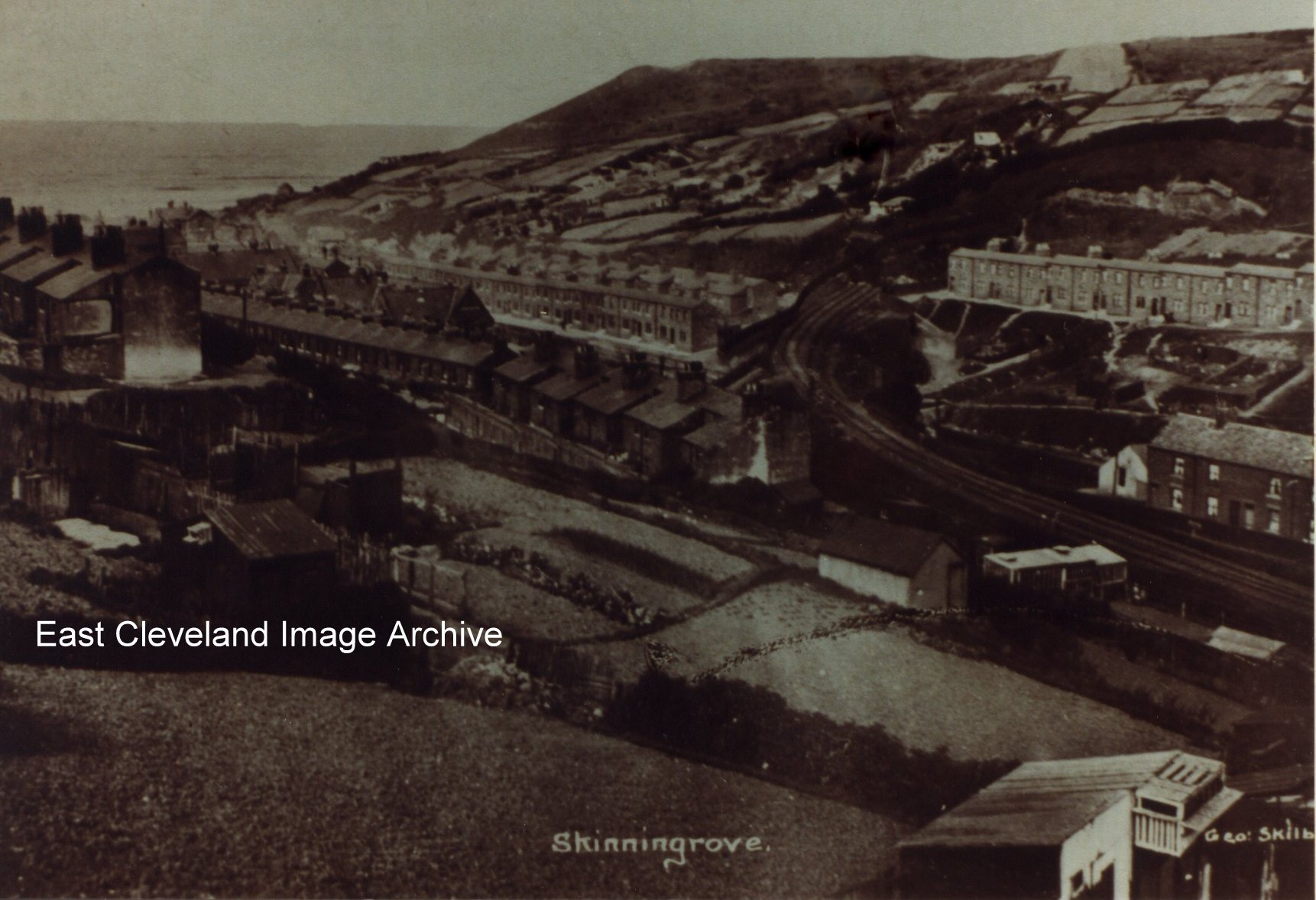
How clearly the zig zag railway can be seen in this photograph, Grove Hill to the right and Zetland Terrace to the left of it. In the left hand bottom corner is written Geo. Skilbeck; he being the photographer (his shop was located on Zetland Road , Loftus). This being one of a vast number of postcards that were sold by Mr. Skilbeck in his shop in Loftus.
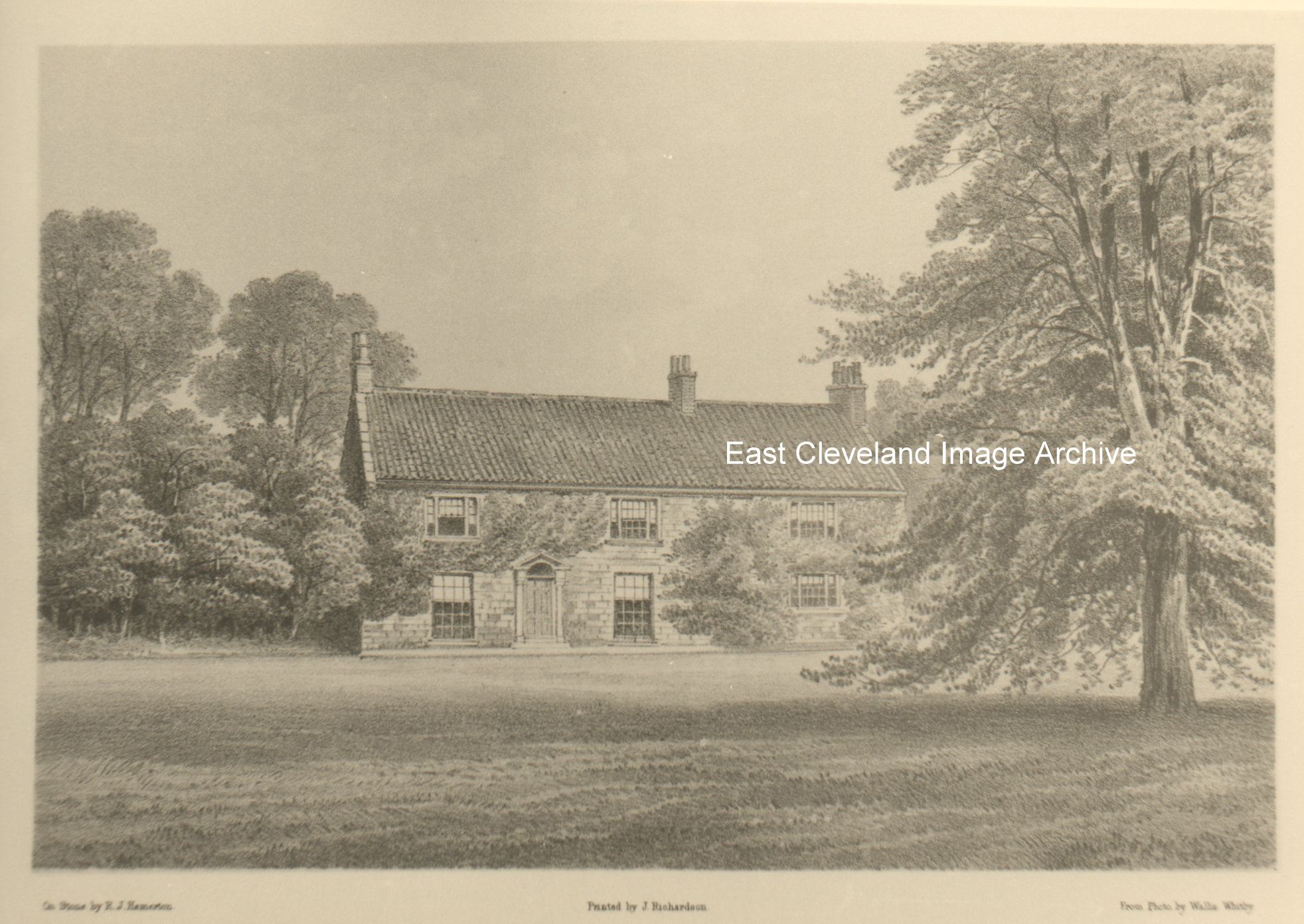
Once again, beautiful though it is, the Archive had no idea where this was and asked for answers. Eric Johnson advised: “I think it’s an old print of Handale Abbey farm, built using part of the priory buildings.”
Thanks to Eric Johnson for that update.
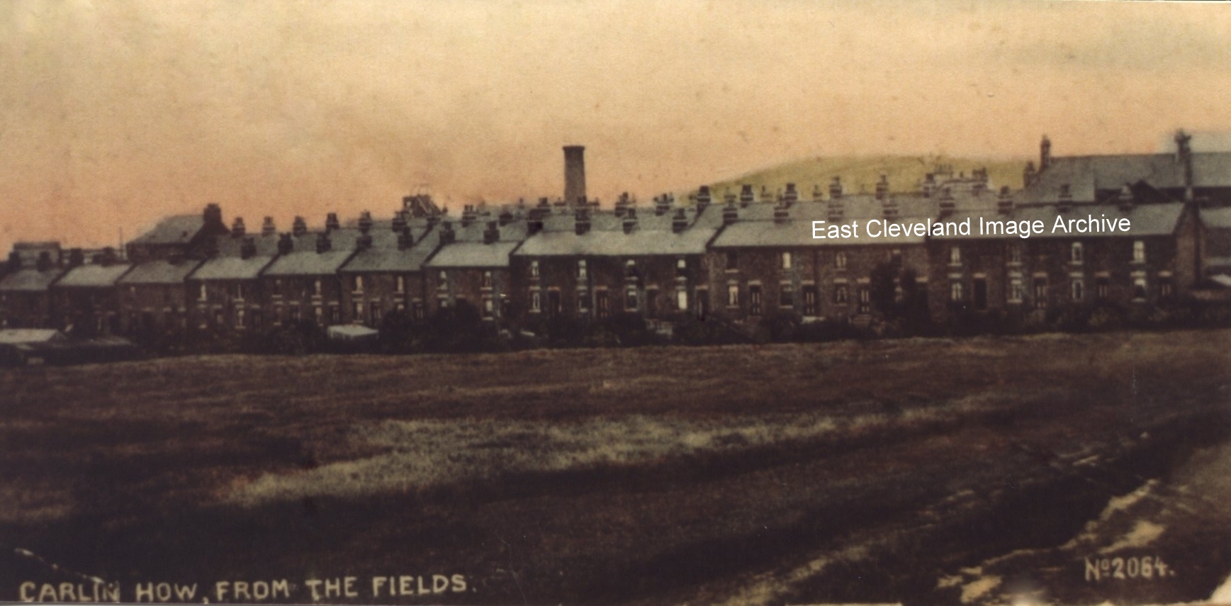
Wood Street, Carlin How viewed from 1960s Welding Shop and 1990s Goodhall’s Timber Company site; now the new estate at the rear of Cliffe Avenue. Derick Pearson raised a question about :”Between this high roof house and the old Chimney, there is a Pit head gear. There was a pit shaft there that not many knew of but some said could it be the aerial rope-way for the tippler for the Buckets coming from Skinningrove mine?” John Pearson with information gleaned from the Cleveland Ironstone Mining Museum advised: “Loftus mines ironstone was transported up to Skinningrove Works from 1895 by connection into the abandoned workings of the North Loftus mine to avoid paying haulage charges to the N.E.R. By 1932 the North Loftus shaft steam winding equipment was thoroughly antiquated so the aerial ropeway was built to avoid using the shaft which was later filled in.”
Information and image from a cd produced by Derick Pearson in 1980s, thanks to John Pearson for the update.
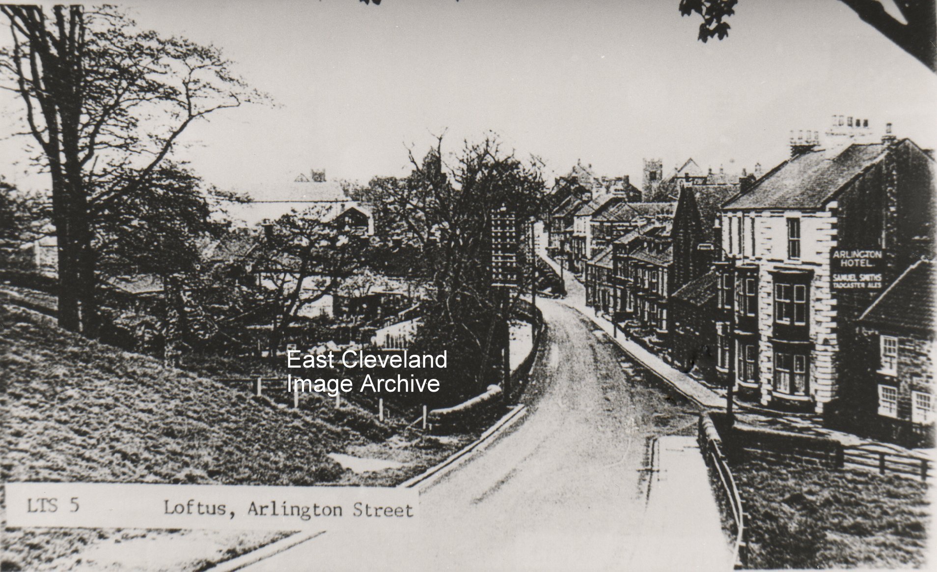
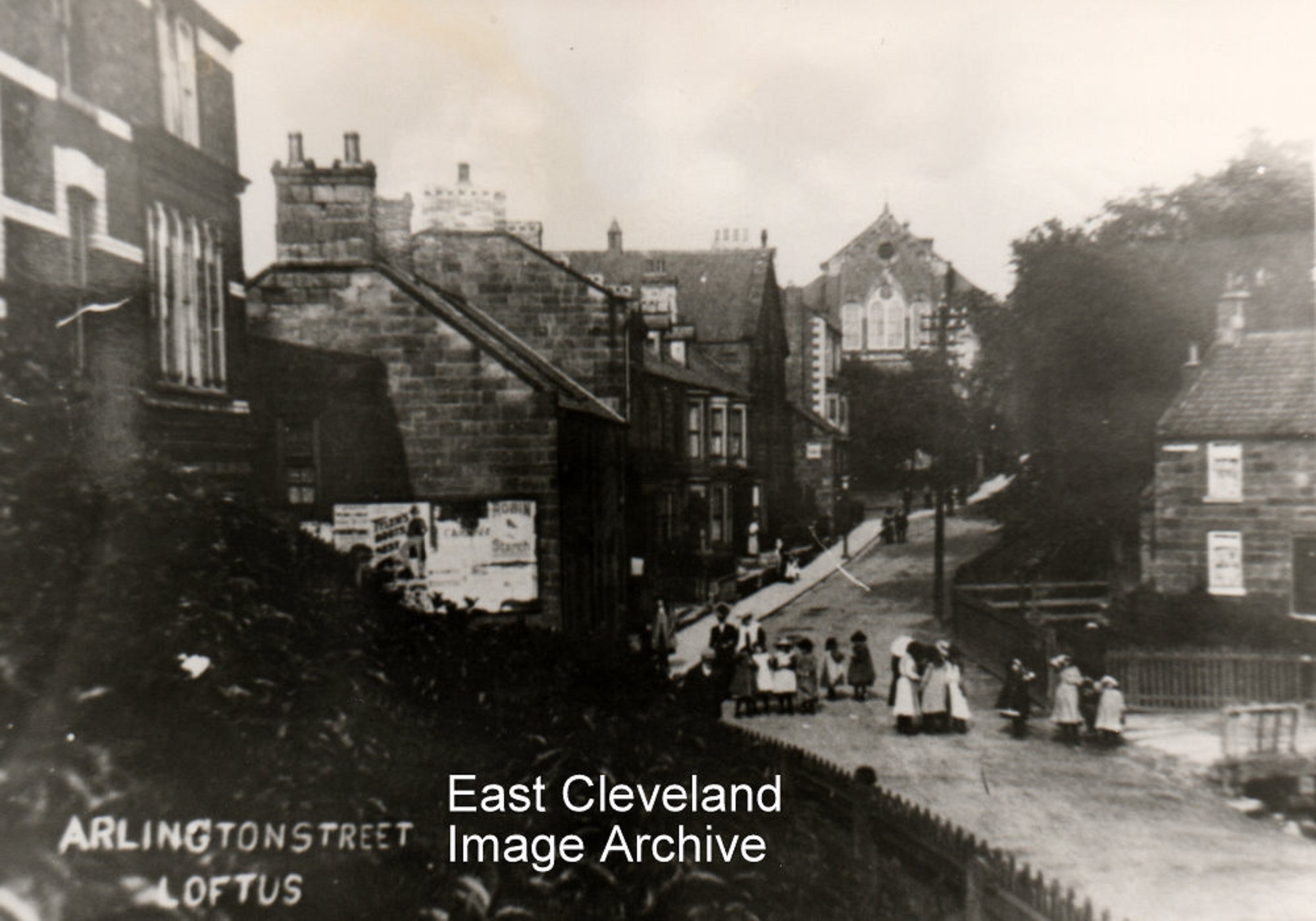
This postcard image presents a different view of Arlington Street taken from Chapel Bank; on the left hand side it shows the grassy bank and the beck that was piped when the estate was built. The right hand side, showing the entrance to East Crescent the triangular fenced/walled area was previously occupied by the Newton Memorial Chapel.
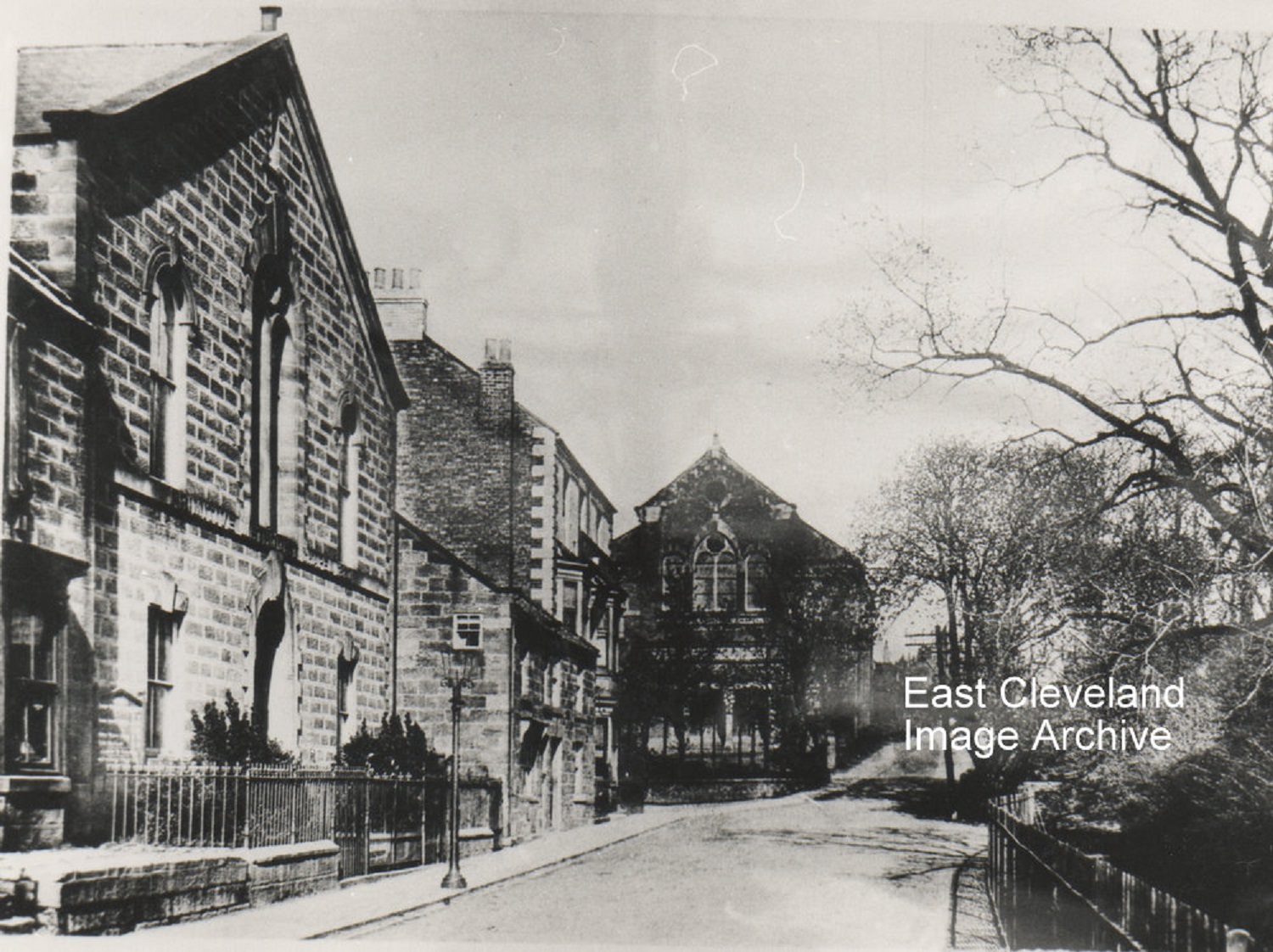
Arlington Street in winter sunshine, it shows clearly the two chapels; the Primitive Methodist on the left and the Wesleyan (Newton Memorial) on the hill. The Arlington Hotel is between them and couldn’t open until after 7 p.m. on Sunday evenings. The houses between the Arlington Chapel and the Hotel were demolished for the chapel hall to be built. Now the hall has been demolished and the chapel is no longer used.
Image courtesy of Mrs Sakelaropoulos.
A rather big gathering on Arlington Street and the people all look to be dressed in their best could it be a Sunday, have they been or just coming home from church? The Newton Memorial Chapel in the background was destroyed by a bomb in World War II.
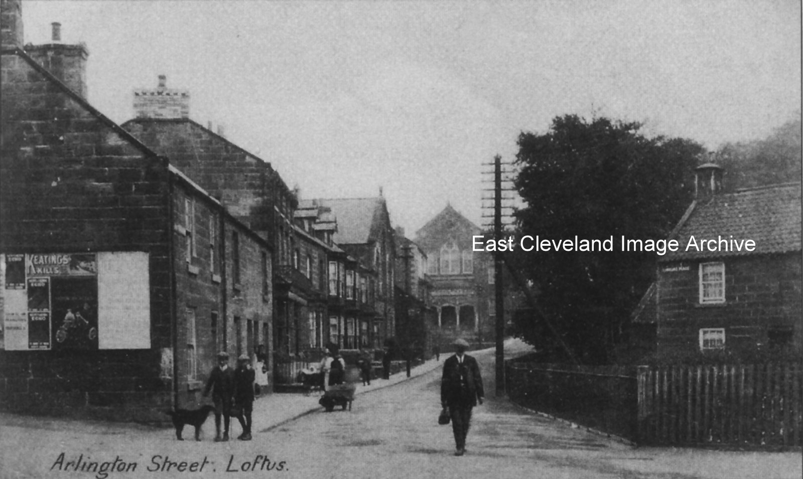
Another well photographed location, this view from a postcard included the information that the gentleman in the foreground was ‘Kind George’; so named as he was the Relieving Officer. Part of his duties included doling our parish relief. A road sweeper is busy in the gutter, hauling his barrow behind him; the billboard on the end of Springhead Terrace has long gone. The telephone pole jutting out onto the road (now where there is pavement) at the end of St Hilda’s Place, was the cause of many road accidents.
Image courtesy of Loftus Town Crier and Jean Wiggins (information confirming from Jean Wiggins “Loftus in Old Picture Postcards”).
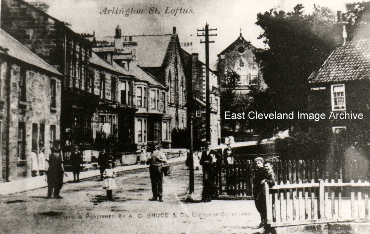
The posers are out in force again, the photograph (from a Bruce postcard view) shows Arlington Street and the entrance to St Hilda’s Place, these must be some of the older houses of Loftus.
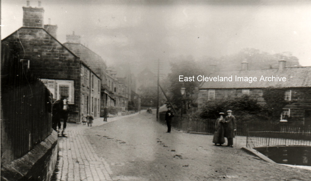
All dressed up and posing for photograph are the lady and gentleman in the photograph, does anyone know who they are? Underneath the gas light (not Lili Marlene!) but a policeman; the horse patiently waiting for it’s owner. The road in this picture looks as though it is not yet tarmacked, lovely and peaceful wish I was there.
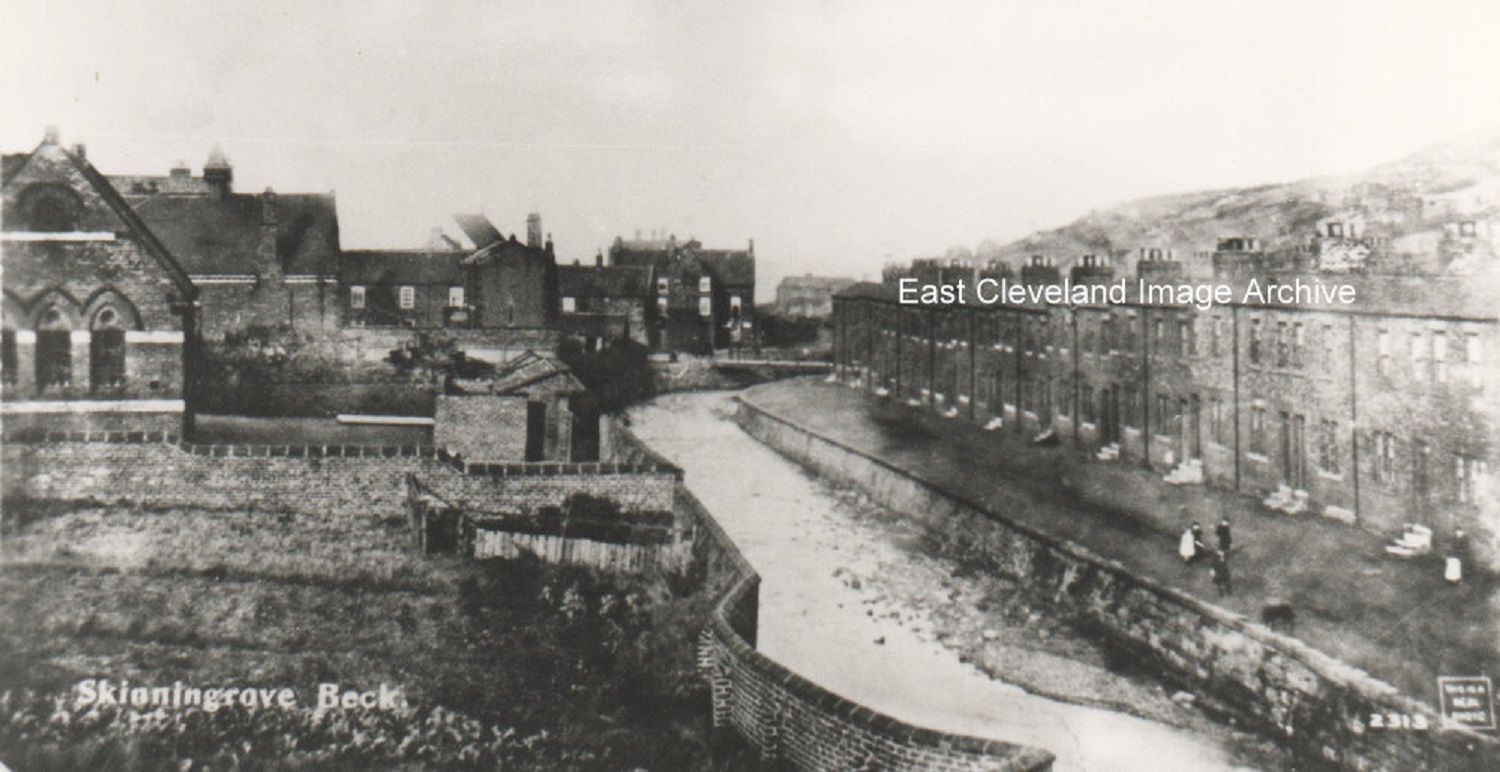
This postcard view of Zetland Terrace and known locally as Beck Row has no railings to stop anyone falling into the beck, even though children were there playing. Railings were erected later but now there is a rather large brick wall there to stop the flooding. The school stands on the left hand side (now entitled Skinningrove Link Up) and still used by the community; once again a large brick wall stops the beck coming into the former school yard.
|
|
Recent Comments