|
|
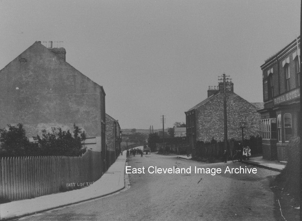
East Loftus Pad ’n’ Can or lodging house was taken down in the early 1940’s, being replaced by Esk Terrace. In the 1911 Census the boarding house was managed by Harry Bowers and there were 18 residents, these included bricklayers, hawkers, labourers and miners. A full house!
Image courtesy of Mrs Sakaropoulus, additional information courtesy of Keith Bowers.
An early tinted postcard view of Marske Mill, beside Skelton Beck and slightly north of the railway viaduct. How in the time of this image the valley must have reverberated to the sound of the train passing overhead.
Image courtesy of Julie Tyrka.
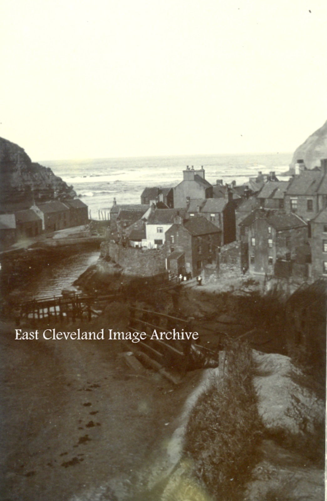
This postcard view of Staithes, towards the harbour was being used as a Christmas card in 1904.
Image courtesy of Ann Wedgewood and Keith Bowers.
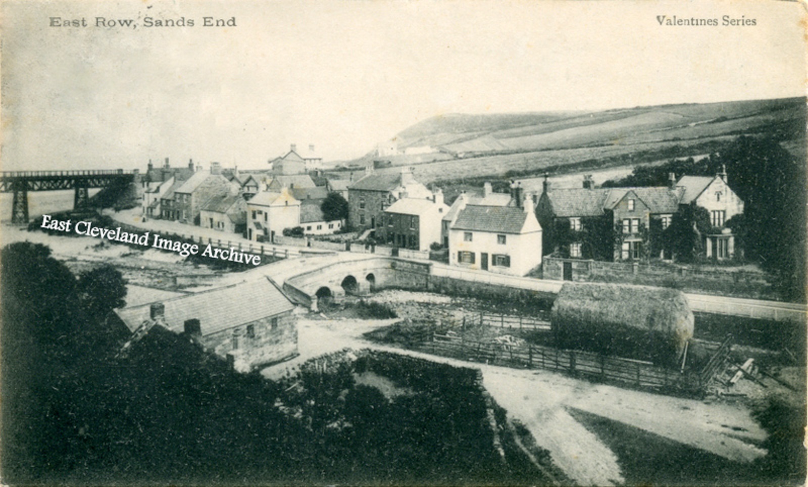
A Valentine’s series postcard post marked 1904, showing a quiet village undisturbed by motor traffic. How different today?
Image courtesy of Ann Wedgewood and Keith Bowers.
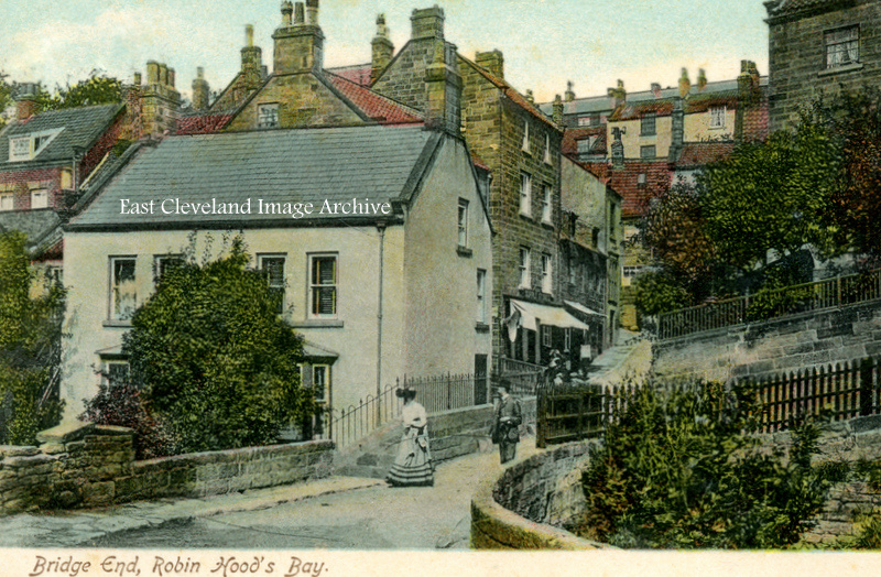
Dating from 1905 this postcard view is little different today. The vegetation even in more modern times replicates that on the image. At times there is still as little traffic owing to the nature of road access to the lower village.
Image courtesy of Ann Wedgewood and Keith Bowers.
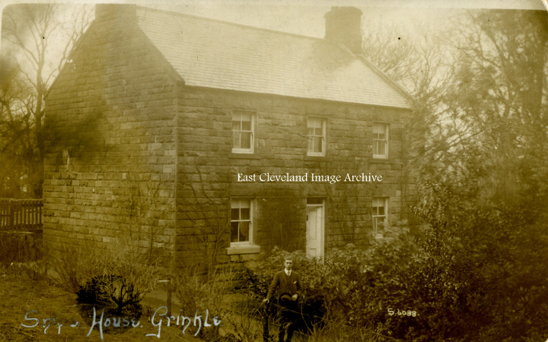
This 1912 view of Snipe House shows a very serious young man in the foreground, do you think he came a-courting?
Image courtesy of Ann Wedgewood and Keith Bowers.
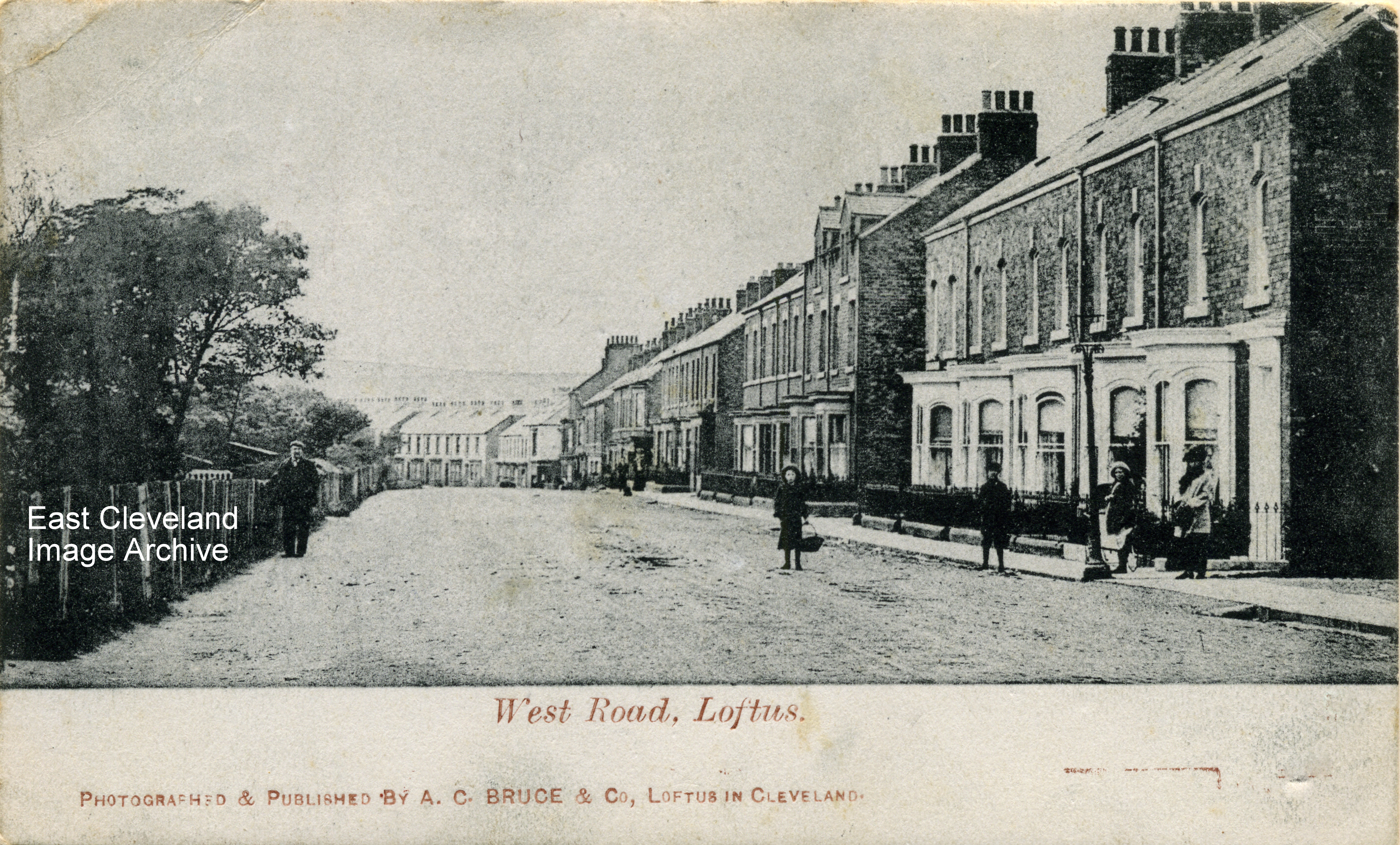
A Bruce postcard view of West Road, Loftus post marked 1904; prior to the building on the south side by George Hebditch, note the still un-metaled road and the casual attitude to possible traffic by the onlookers. No. 26 West Road is the fourth house down in the second block of houses on the right hand side of this image; next door to the present day dentist’s at no. 27. Norman Patton advised: ” I have a birth certificate for my Mother’s Auntie Alice May Hicks who was born in No 26 in 1895. According to the 1891 census, her parents were already living at 26 West Road where they were the first residents. They had lived at 2 Westfield Terrace at the previous census in 1881 so we have the decade in which those houses were completed!”
Image courtesy of Ann Wedgewood and Keith Bowers, thanks to Norman Patton for the update.
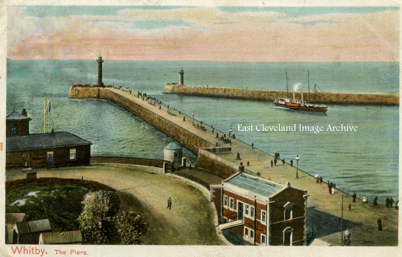
An early view of the piers at Whitby; the taller buildings on the Battery are absent, to-day the lower part of Khyber Pass is flanked on the lower side by cafes and restaurants. The pier seems well thronged with those taking the bracing airs or perhaps they had come to see the paddle steamer return to port; any one for a trip round the bay?
Image courtesy of Ann Wedgewood and Keith Bowers
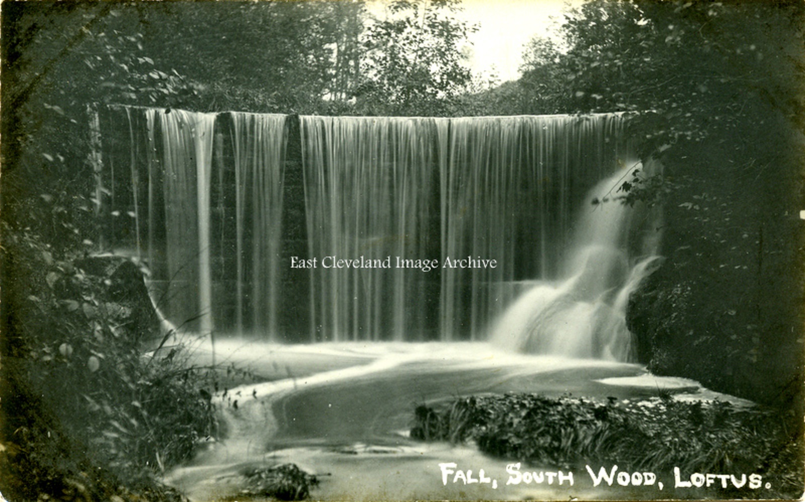
Originally believed to be the waterfall in Espiner’s (Hancock’s) wood, our postcard view is undated; but is possibly from the early 1900s. Jonathan Dales suggested: “This waterfall maybe in Handale wood.” Bryan Richardson has confirmed with: “This waterfall is the one in Handale Wood about 300 yards towards Handale from Slaters Banks. The waterfall in Espiner’s wood is flatter than the one in Handale. The railway embankment would also be in the background in Espiner’s. The waterfall is now about one meter lower than it is in the photograph.”
Image courtesy of Ann Wedgewood and Keith Bowers; thanks to Jonathan Dales and Bryan Richardson for the updates.
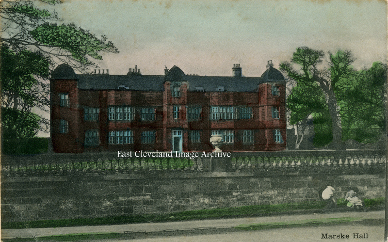
Viewed from what is now Redcar Road, Marske; this postcard view of the then home of the Marquess of Zetland dates from 1905. During World War I it was used by the Royal Flying Corps; they used the airfield at Marske as a training and flying school (the area now occupied by Barnes Wallis Way and other similarly aeronautical named roads).
Image courtesy of Ann Wedgewood and Keith Bowers.
|
|

Recent Comments