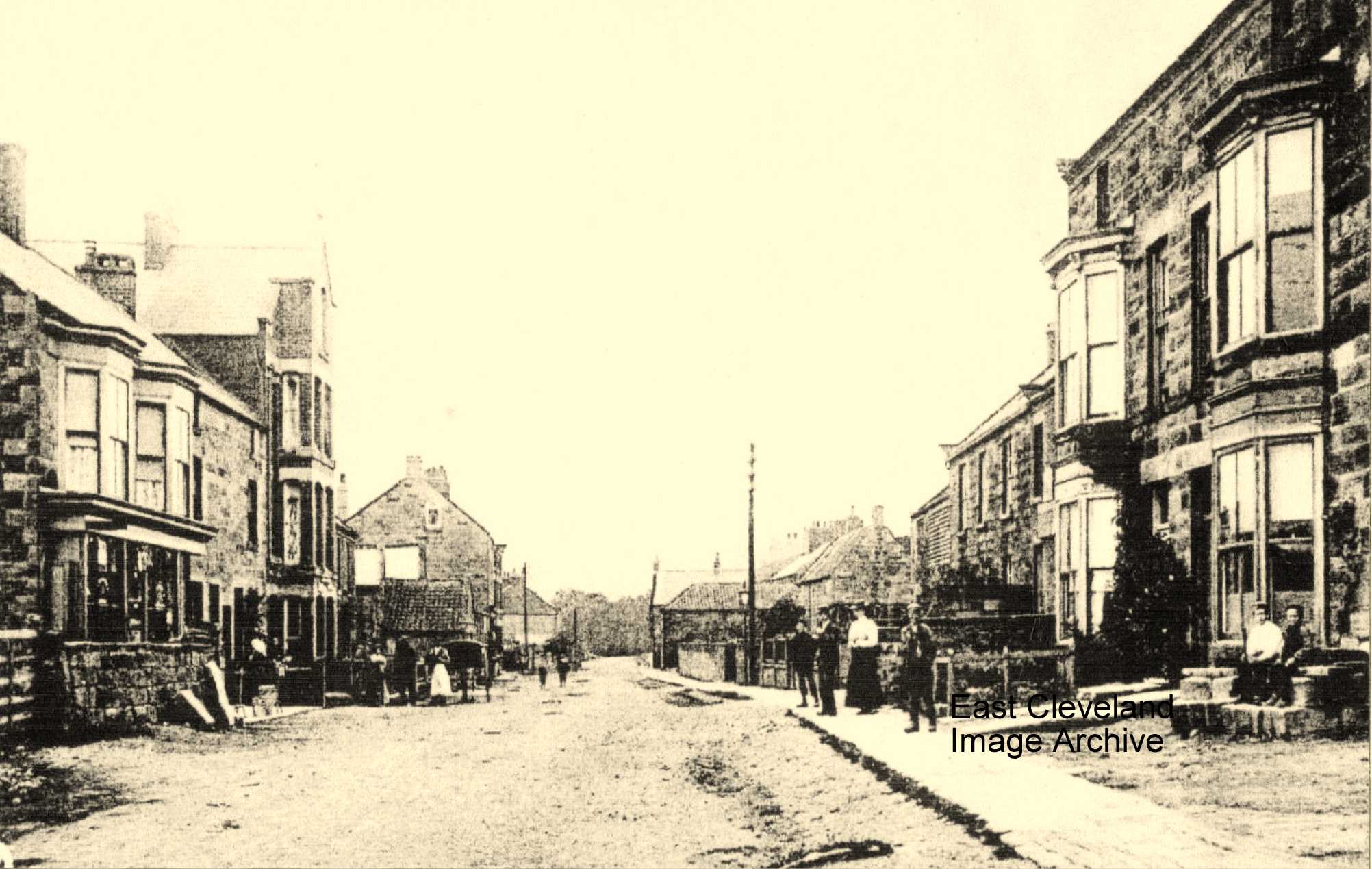
Hinderwell High Street, around 1900; the curious onlookers gaze at the cameraman having set up his equipment in the middle of the road, at this date it’s doubtful if a motor car had been seen in Hinderwell
Image courtesy Maurice Grayson.
|
|
||
 Hinderwell High Street, around 1900; the curious onlookers gaze at the cameraman having set up his equipment in the middle of the road, at this date it’s doubtful if a motor car had been seen in Hinderwell 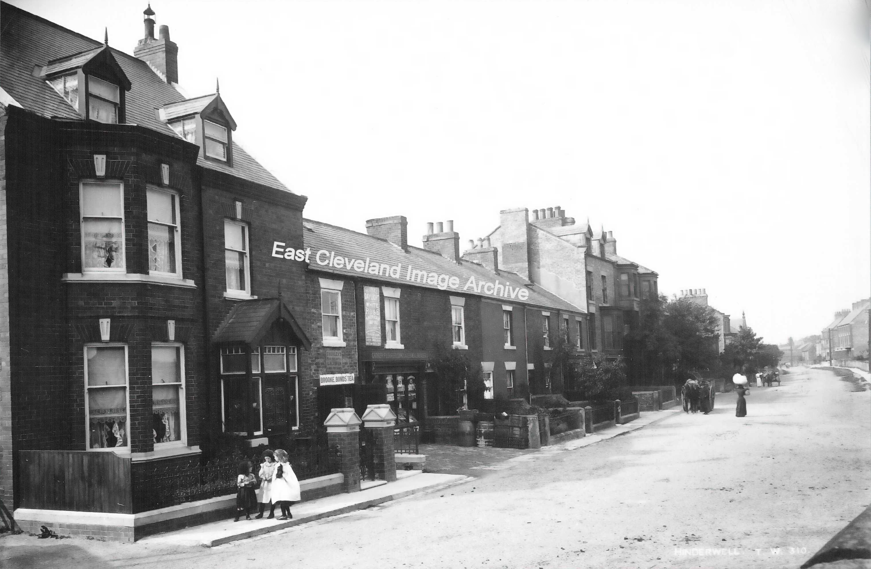 A late Victorian scene in Hinderwell, the lady walking down the road would seem to be carrying a white bundle on her head. Whilst the three girls pass the time away on a day off school? 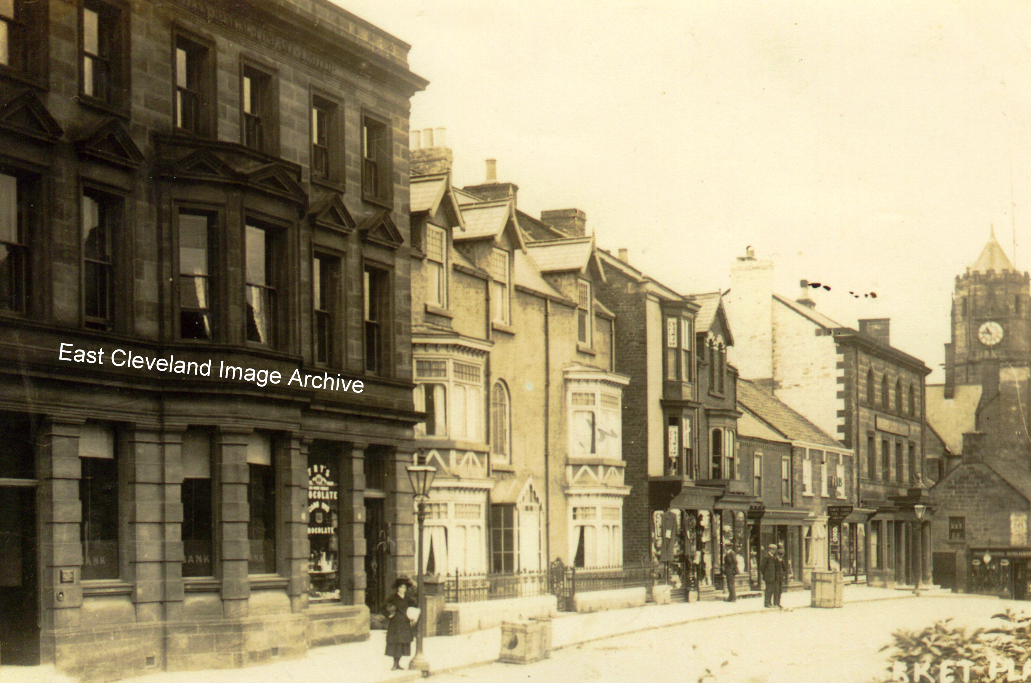 A very early pre Great War view of the Market Place showing what was the then Martin’s Bank on the extreme left; with the attached shop of Fenby’s. Next door being Arbroath House and then Riley’s emporium (this was replaced by the Regal Cinema). We then come to Charles T. Cammell’s shop, next is William Maxwell Race’s premises followed by the Golden Lion Hotel. These premises are the source of the old joke about a Race between a Camel and a Lion in Loftus Market Place. Postcard courtesy of John G. Hannah 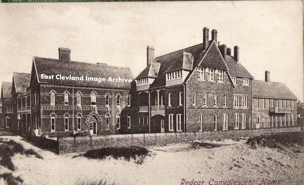 Yes I know it’s Redcar but where in Redcar? Dave Woods advises: “The convalescent home was where the Coatham Bowl/Leisure Centre once stood. On your photograph the left side of the building faced the sea.” Image courtesy of Pat Bennison, thanks to Dave Woods for the update. 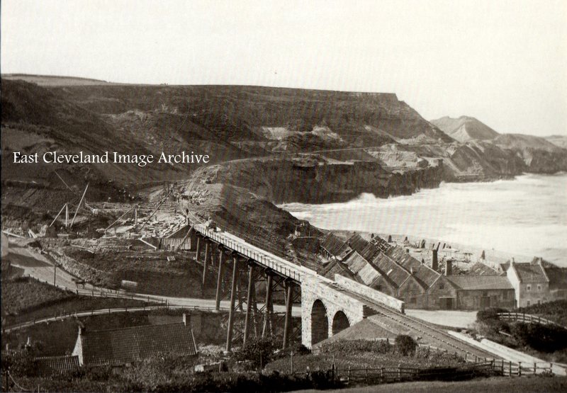 We did not know the date of this photograph, but realised it was the building of the railway and station. Geoff Patton advised us: ” Looking at the block of houses on what would be the beach, now; I heard these were bombed flat during one of the wars. I’d guess the railway station was built mid 19th century.” This made us research further and have found that the station at Sandsend opend 3rd December 1883, thus this image is prior to that date, possibly 1882. We will research further. Image courtesy of Pat Bennison; many thanks to Geoff Patton for his update. 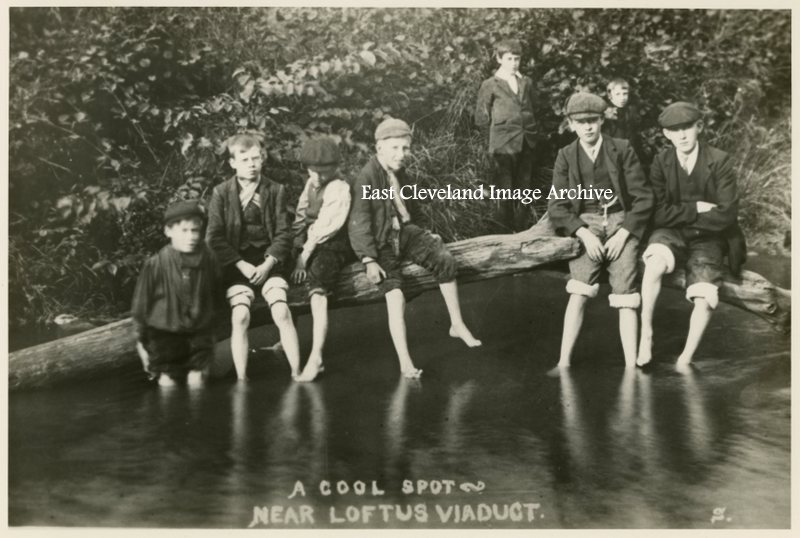 Near Loftus viaduct is the caption and a long time ago by the look of the clothes worn by the boys; can you date it? Image courtesy of Pat Bennison and the Pem Holliday Collection. 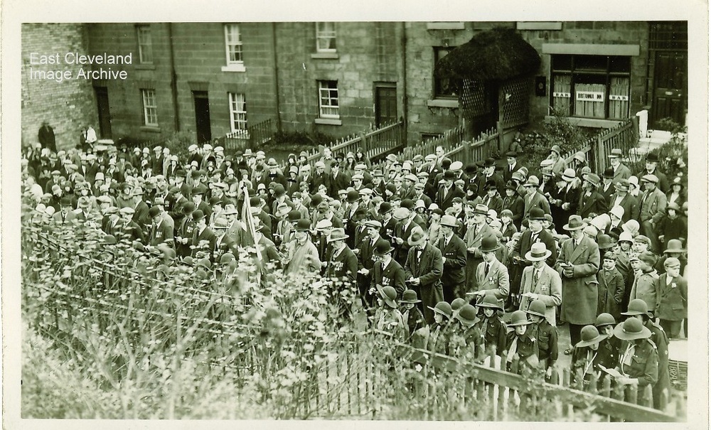 A well attended Remembrance Day Service, believed to be 1924. Note the numbers of gentlemen wearing medals, World War I was still vivid in the memories of all those attending. 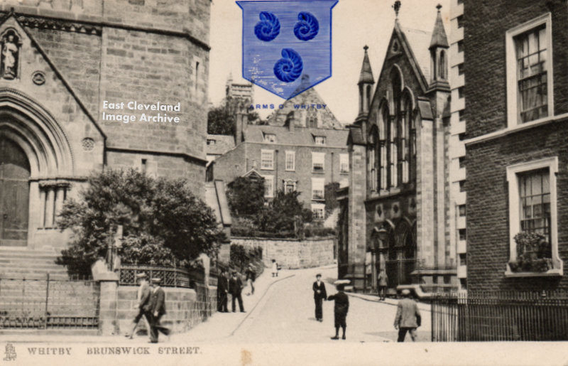 This postcard view of the corner today is little changed, although the end is a one way street, the buildings all remain. Today the church at the top of the photograph on Flowergate has lost it’s tower and I would not recommend standing in the middle of the road! David Richardson tells us: ”The brick building on the right in the foreground was partially demolished to allow the junction between Brunswick Street and Bagdale Road to be widened.” 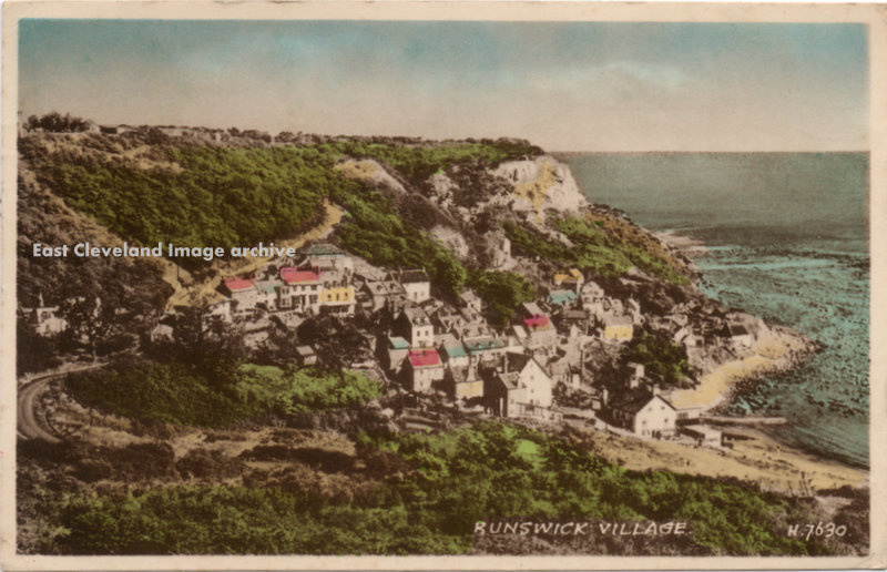 A delightful postcard view of Runswick Bay, complete with the ‘old’ road which led to the village. More recently the more direct route down was developed owing to land slipage. Image courtesy of Ken Johnson. 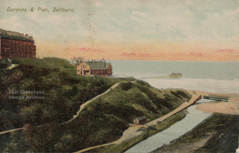 Callum Duff advised the Archive: ”This photograph was taken sometime between 1902 and 1924. The Assembly Rooms have been improved externally (this taking place in 1902) and the pier still has its original iron legs stretching to the the pierhead. On the 7th May 1924, the SS Ovenbeg breached the pier, leaving the pierhead adrift. The breached section was later repaired in steel which altered the appearance of the pier legs. This can be seen in later photographs from the same spot.” Image courtesy of Ken Johnson and many thanks to Callum Duff for the dating and update. |
||
Recent Comments