|
|
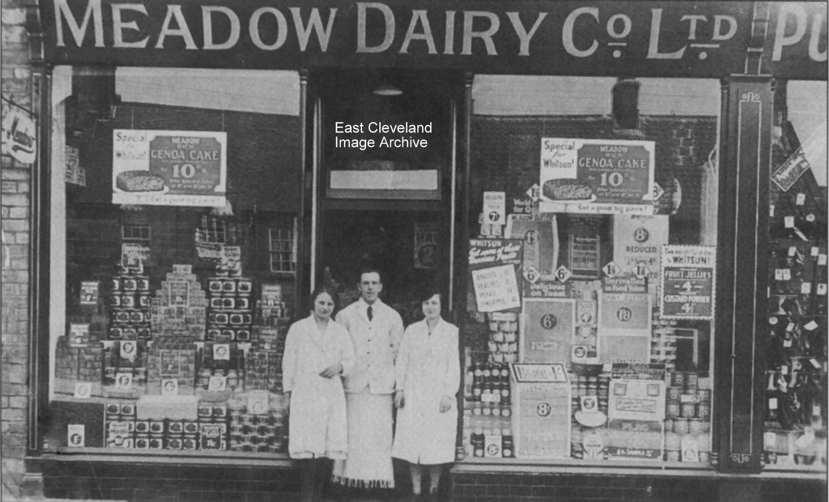
Meadow Dairy was on the High Street, next to the present day Post Office; previously a Tattoo Parlour and is now part of the ‘My Price’ food shop. In 1924 the Manager was Mr Joe Anderson and is shown flanked by two assistants, one of whom is known to be Miss Elsie Burton and an unknown assistant. Mr Anderson won prizes for window dressing and many of his displays were astonishing.
Can anybody help in identification of the other young lady?
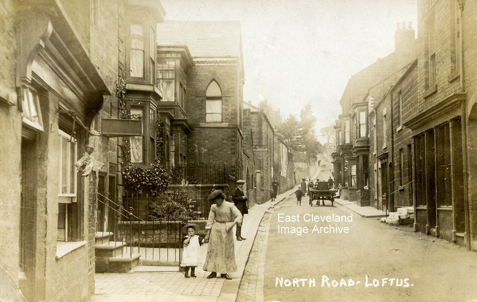
North Road (earlier called Lambs Lane) around 1900 – from a T.C. Booth of Loftus postcard – the date being assumed from the postmark which the card carries of August 1912. Adam Cuthbert asked: “What was the building that’s now the road to North Road car park and when did it get knocked down?” Eric Johnson tells us: ”Ally Watson’s dairy was in the building with Hodgson’s sign. Further up North Road was access between the parish hall and this building to Laurie Gibson’s butchers barn and slaughter-house. The bottom half of this building was used to store the stalls for the Market Place, the upper part being occupied as a house by a family called Lindsey. All were demolished along with the council yard for the car park. The house built out onto the road with the lancet window is Forge House, with the smithy next towards the parish hall. Ally Watson later used the smithy building for his dairy and milk round. The first shop on the left was Gibsons butchers. The shop opposite used to belong to Billy Clark, no relation, who played for Loftus Albion in the Northern League. Then Jim Kelly’s off-licence, his wife was a member of the Trillo (ice cream) family. Clarks shop next to the butchers was formerly Cyril Whitlock’s grocers.” Can anybody assist with dating this alteration?
Image courtesy of Jean Hall and thanks to Eric Johnson for the updates.
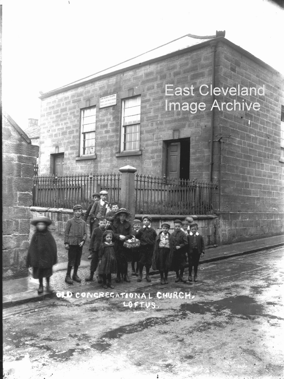
The caption on this postcard view says ”Old Congregational Church, Loftus”, the plaque between the windows says ”Ebenezer Chapel”, so they were both right. Built in 1827 in North Road (then called Lambs Lane), it accommodated 180 people and over the doorway was an inscription ”Si deus a nobis est qui contra nos?” which in English means ’If God is with us who shall be against us?’ The church was replaced in 1906 by the church built on the former monumental mason’s yard at the corner of West Road and Westfield Terrace to accommodate more people; the ”Ebenezer” when disused later became the Parish Hall. Now refurbished as a private property and currently up for sale, this fine old building looks as austere now as it did then. The obligatory group of onlookers makes this picture, don’t you think? Can anybody explain why it looks like a building of two halves, with each half a mirror image of the other?
Image courtesy of Ann Wedgewood & Keith Bowers, information courtesy of Jean Wiggins.
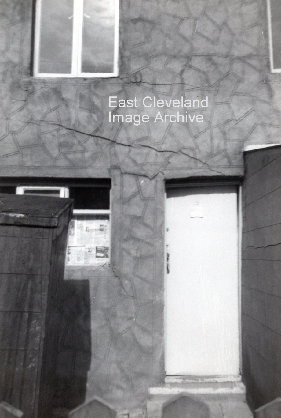
Number 2 East Street, was badly affected by the subsidence. The doors jammed and the occupants couldn’t get out. The nightwatchman’s hut was in the yard of number 2 in this photograph. He was on duty because of the coal gas in the mains and had to go round at night testing for gas and for water leaks. Numbers 2 and 3 East Street had to be demolished because of the damage.
Image and information courtesy of Eric Johnson.
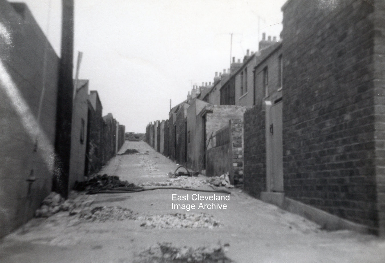
Eric Johnson took this set of photographs recording the damage caused to houses in Gladstone and East Streets by the collapse of mine workings c.1962. This is the view looking up the backs with Gladstone Street on the left and East Street on the right. The gas and water mains were broken in several places and the road had to be dug up.
Image and information courtesy of Eric Johnson.

Damage to the walls of numbers 4 and 5 East Street caused by the subsidence is clearly visible!
Image and information courtesy of Eric Johnson.
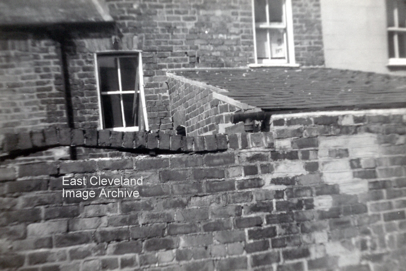
Houses at the bottom of Gladstone Street were also affected. Cracks appeared in the walls and the bricks on top of this yard wall lifted. When they were repaired three houses were knocked into two.
Image and information courtesy of Eric Johnson.
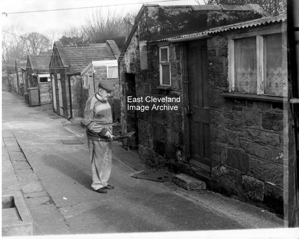
Mr Jim Fishlock approaching the coal house and former outdoor toilets at South Loftus ; in the days before flush toilets, ash pans were used and emptied each week by a council dustbin lorry. Dustbin men in those days were colloquially known as ‘night soil men’!
Thanks to Paul Brown for the update.
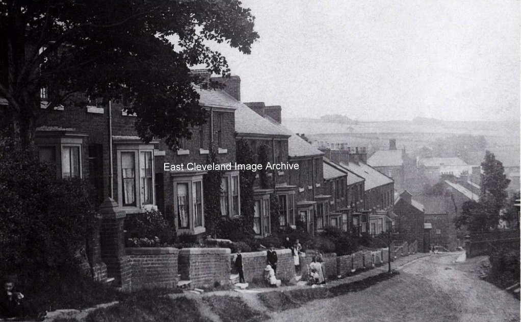
Next one is Loftus Seymour Hill. we are baffled a little with this one, as the building in the center right which would be to the right of the Market place seems unfinished on the right hand Gable end. The angle of the shot is a little confusing but it must be looking at the Church area as the spire is visible. Seymour Hill is well established with trees growing and well established gardens. Paths from the gardens to road are well-worn and it is an old gravel road. The bay windows of the houses of Robinson Terrace are just visible on right. Come on you historians, fill in the rest.
Adam Cuthbert suggests “The building could be the former NatWest (previously National Provincial) Bank or the Golden Lion.”
Image courtesy of the Pem Holliday Collection, Derick Pearson and Joyce Dobson, also thanks to Adam Cuthbert for the update.

A fine archival quality sepia of North Terrace, taken from the Loftus end of the road. Carefully posed, but notice the two “observers” in the garden of the first house with the bay window, also unless I am mistaken the gate on the left of the picture is still there!
Image courtesy of the Pem Holliday Collection, Olive Bennett and Joyce Dobson.
|
|


Recent Comments