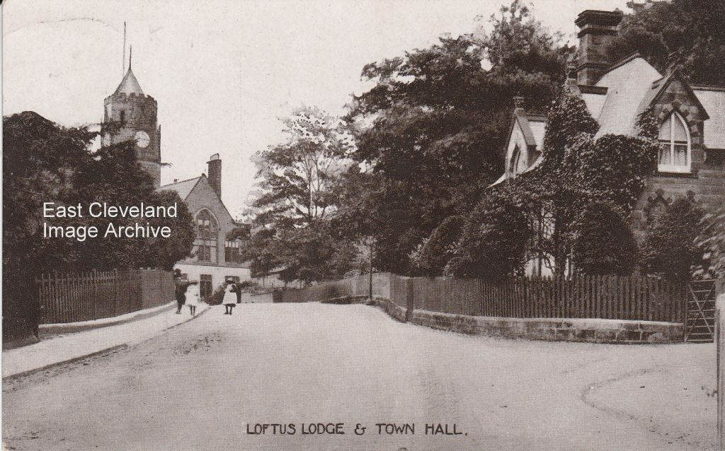
Another postcard from the John Thomas Ross photographer and postcard producer of Whitby; f Hall Lodge and the Town Hall taken from the usual vantage point.
Image courtesy of Ruth Wilcock.
|
|
||
|
Another postcard from the John Thomas Ross photographer and postcard producer of Whitby; f Hall Lodge and the Town Hall taken from the usual vantage point. Image courtesy of Ruth Wilcock.
One of my favourite photographs although not as clear as it might be; the lodge house entrance to Hall Grounds, Loftus. It hasn’t changed much over the years.
We’ve wondered about this one for a long time; having just found a similar image in Jean Wiggin’s book, ’Loftus in old picture postcards’ and cross-checked the hall out in Street View on Google Earth. It’s hard to recognise now, with Hall Grounds built up all round it, but the hall itself remains very much as it is in this picture. The image came from a printed selection by J. Richardson of Loftus, although as yet have not defined a date of publication. Image courtesy of the Pem Holliday Collection.
The beginning of the end for Street Houses; the image is taken from a Northern Echo newspaper cutting, we continue to hope for an improved version!.
This must be one of our earliest photos of Mill Bank (correct me if I am wrong) but it is the only one I have seen of the bank with horses and carts going up it. Looking closely the road doesn’t seem to be made up, is it? Duck Hole pit that can be seen on the left and through the haze top right Mount Pleasant? The huts in the field were used to house the Australian Army in World War I. Thanks to Kathleen Hicks for the update.
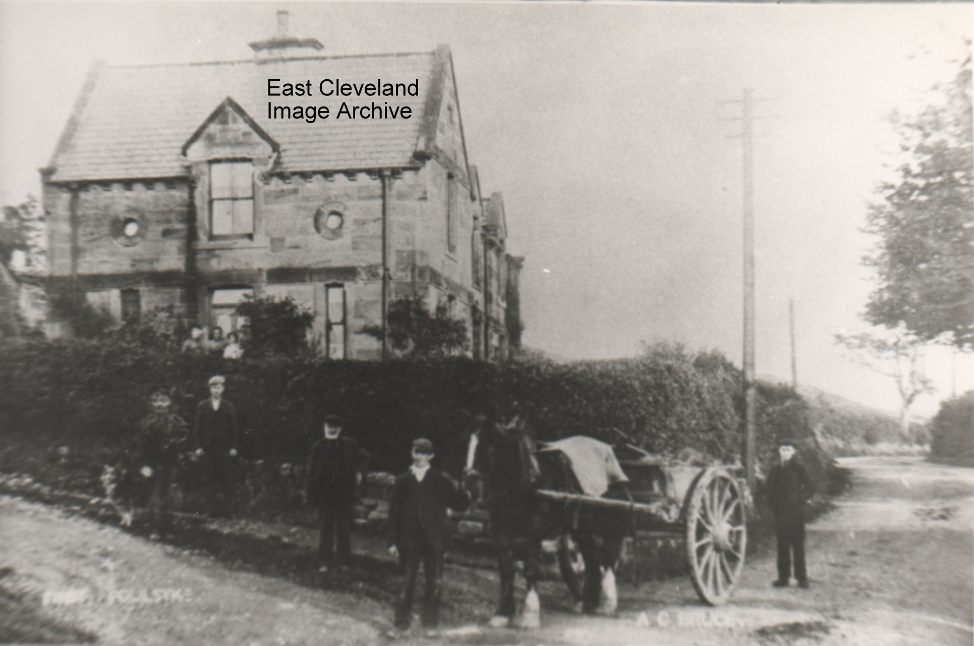
Looking down the bank from Carlin How, this is before the bank was altered it was a tight corner under that bridge, we can see where the railway went over and the bank going up to Loftus. Derick Pearson tells us: ” This was a difficult bend to negotiate and if two buses came from opposite directions one had to back off to let the other pass. Under the bridge itself were some very large timbers in an A frame construction supporting the sides. I remember when only in my teens there was a motor bike accident in which a bike crashed into a Saltburn Motor Service bus, possibly the late 1950s or early 1960s, this was a not infrequent incident under this bridge.” When was the bank altered? Thanks to Derick Pearson for the update.  First Foulsyke as we always knew it; but this must be a very early photograph with no pavement and no tarmaced road. All the locals are out to have their photograph taken. Built by Lord Zetland from local stone, this row of three cottages (now two) was built to house cow keepers, who supplemented their income by renting land to support a couple of beasts. The name ”Foulsyke” means a ’muddy valley’. The residents in the 1940’s were: Readmans in the first house; Swalwells in the second house and the third one (correct me if I am wrong) was either a Miss or Mrs Shaw. Swalwells still have the farm; there was always a spring running in the farm-yard, where those that lived at East Loftus used to go and get water from when the taps went off. Which in the 40’s and early 50’s was very often. Information courtesy of Jean Wiggins.
A very busy day on Mill Bank – two buses! – a lovely view of Kilton Beck and Kilton Mill; with Duck Hole pit in the background to the left.
A bus half way up the bank and the entrance to Glover’s Path on the right; a pile of logs in the field (or are they pit props?). On the skyline on the left you can just make out St Hilda’s Terrace.
A beautiful quiet lane (and I wish I had a £1 for every time I had walked it) beautiful views all round but as usual the iron and steel works dominate the skyline. |
||
Recent Comments