|
|
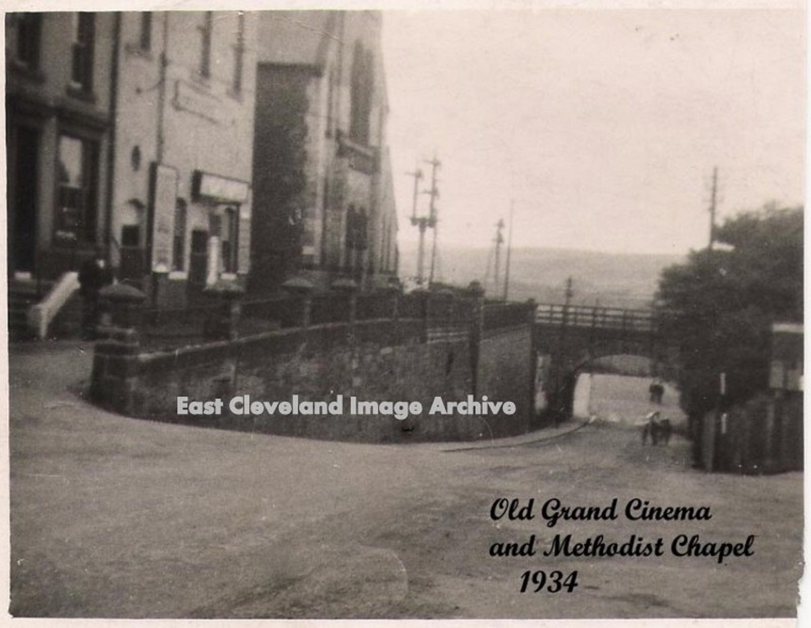
The title on this postcard view of Brotton High Street tells it all. Both the cinema and chapel long gone (their absence marked by an extensive parking area), although the public house ‘The Railway Arms’ (steps in left corner) still remains open today. Larraine Goldby comments: “I well Remember attending the Methodist Chapel during the fifties! Good memories I lived in Brotton on coach Road from 1953 until my marriage in 1961.” Image courtesy of Julie Riddiough, thanks to Larraine Goldby for that memory.
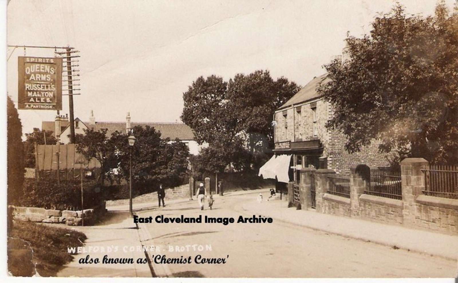
Chemist Corner as the title also tells us is now the location of an estate agents, as well as a photographic shop. Originally known as “Welford’s Corner” this view also includes the original sign for the Queen’s Arms (Blood Tub to locals). This postcard view in more quieter days, possibly before the War Memorial was erected, the space seems to be occupied by a building. We asked if anybody could assist the function was of this building. Julie Riddiough tells us: ”It was the Kingdom Hall, a little shed type building where the Jehovah’s Witnesses would meet, there was also a shoemakers (or cordwainers as they called themselves then) behind it. Im not sure if its there now but up until about 2 years ago the shed it’s self, all dismantled was actually still there in pieces propped against a wall.” Malcolm Moore tells us: ”I remember at the beginning of the war being marched down from the school to Kingdom Hall to be issued with our gas masks. All very exciting!”
Image courtesy of Julie Riddiough also many thanks to Julie and Malcolm Moore for the updates.
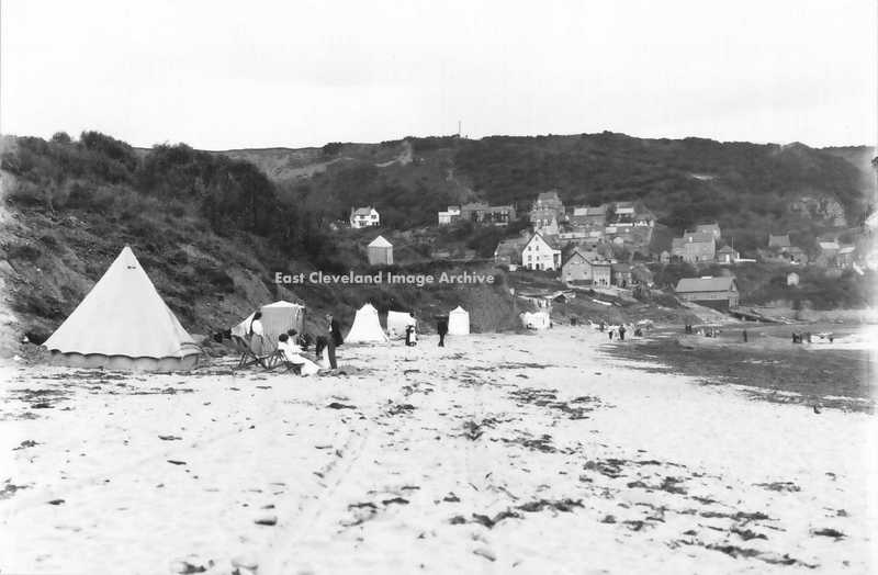
Runswick Bay Beach, in Edwardian times. With a variety of tents for ladies to change their beach wear in modesty. The larger seaside resorts had wheeled bathing huts which entered the sea, probably the difficulties of accessing the beach at Runswick led to this innovative method of ensuring the ladies privacy.
Image courtesy of Maurice Grayson.
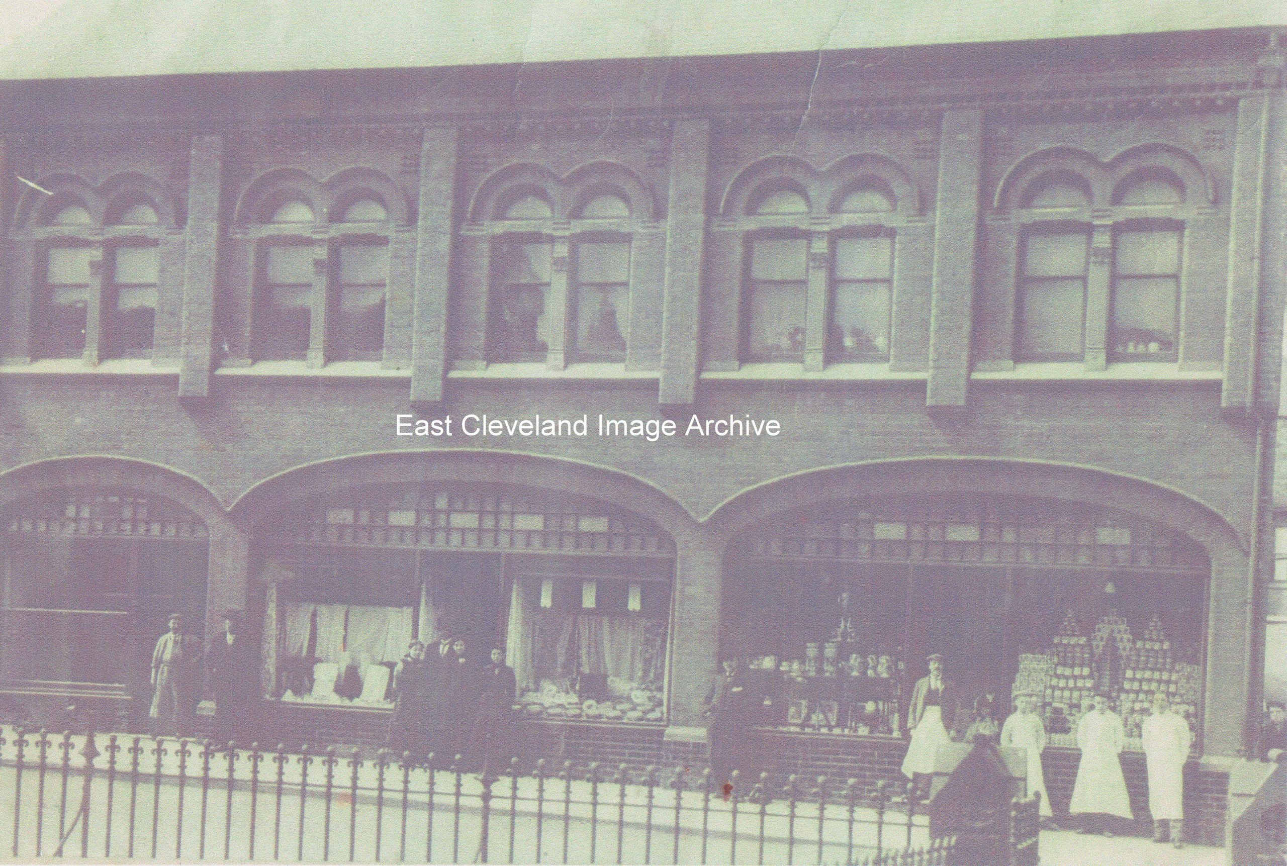
A view of the former Co-op shop in Skinningrove, viewed from the entrance to Timms Coffee House. Such an imposing building in its heyday! From the days of long white aprons and the long wooden counters. Remember the ”dividend”, I can still remember mother’s number from 50 years ago! John Sarginson advises: “My grandfather opened this shop as it’s first manager. I have memories of what my mother told me of her time here around the time of World War 1.”
Image courtesy of Joan Jemson; thanks to John Sarginson for the update.
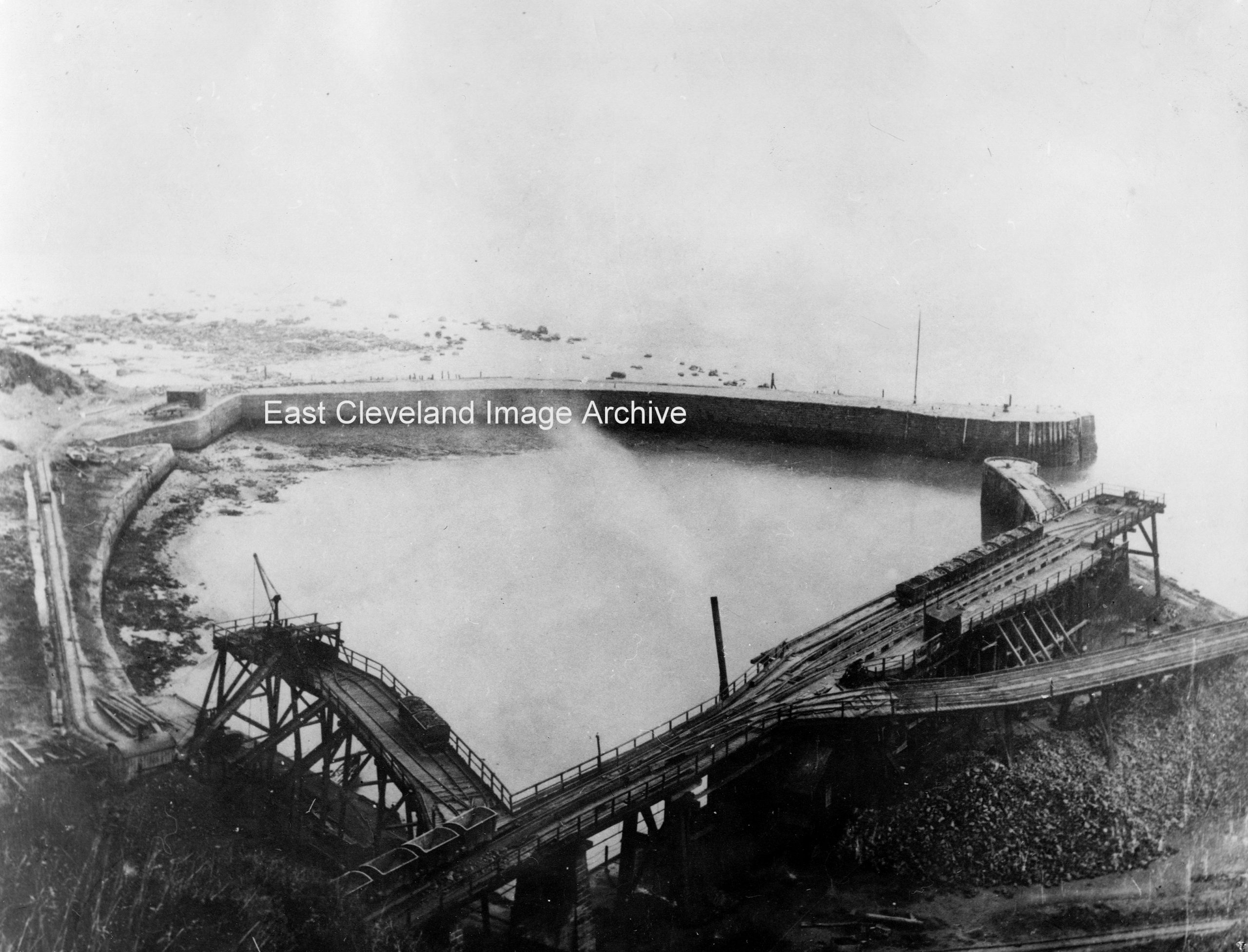
A lovely photograph of Port Mulgrave’s docks; when it actually was a port, built around 1856-57, it was a very busy place serving the surrounding mines. This shows the harbour prior to World War II, the disintegrating remains of Palmers ironstone loading staithes clearly visible; the seaward pier was blown up during the war.
Image courtesy of Maurice Grayson, Neil Suckling and Cleveland Ironstone Mining Museum.
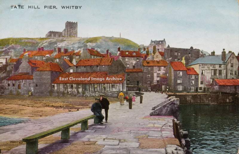
1926 is the date we have for this coloured postcard of Tate Hill Pier, the Lifeboat Station now occupies the right hand landward end of the pier, with the Duke of York Inn behind. At the top left is Henrietta
Street which is currently under threat from Cliff Landslips. David Richardson advised: “The lifeboat station was already in use by 1926 and is sited on the upstream side of Fish Pier which is the next pier upstream off the right of this postcard.”
Postcard courtesy Ken Johnson, thanks to David Richardson for the update.
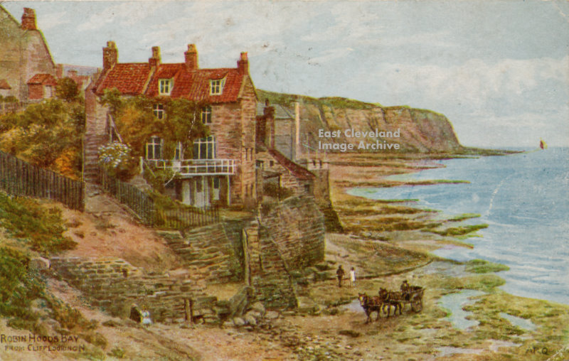
Robin Hoods Bay, Looking towards the landing slipway. Coloured postcard or painting, hard to say? The horses and cart suggest an early date, Possibly collecting kelp, as no fishing cobles are evident; date of card posting is 1947.
Image courtesy Ken Johnson.
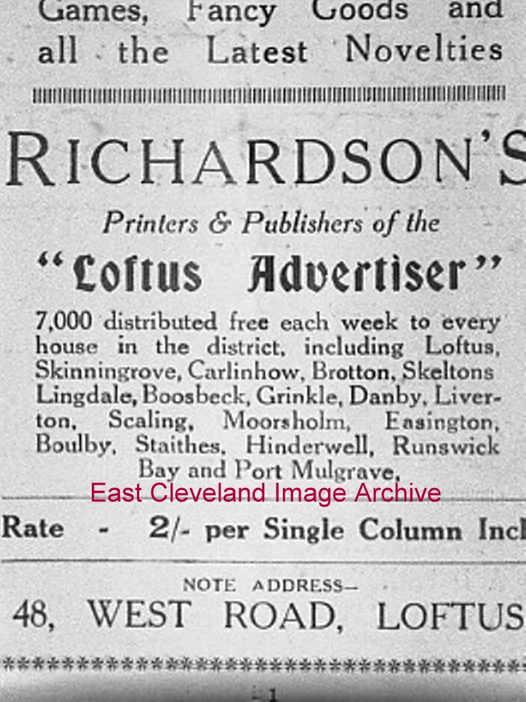
A poster advertising Richardson’s – Publishers and Printers – this description should also include postcards, many are featured on the site. They occupied the premises previously used by Fords and then Martin McColls on West Road. The poster dates from the 1880s.
Image courtesy of Geoffrey Patton.
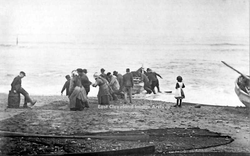
On the open beaches of the Yorkshire Coast, it was all members of the village to help with hauling the cobbles up the beach, when returning from fishing. Apart from the idle youth sitting down kicking at the sand and the girl who is too young. Location now confirmed as Staithes, the ladies bonnets suggest this. David Richardson confirms with: ”An early 1900′s image of Staithes beach, the old timber sticking out of the sea on the left of the image is very distinct in other photos of the time as is the cobble just off to the right.”
Image courtesy Maurice Grayson and thanks to David Richardson for that confirmation of location.
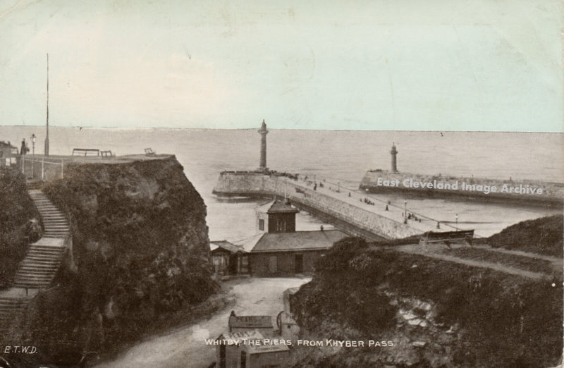
1905 is the date we have for this postcard of Khyber Pass and the piers at Whitby. It may be older as the wheels of a bathing hut can just be seen near the buildings halfway down the bank.
Image courtesy Ken Johnson.
|
|
Recent Comments